Aoraki/Mt. Cook National Park Part 2
Saturday 12 November, 2016
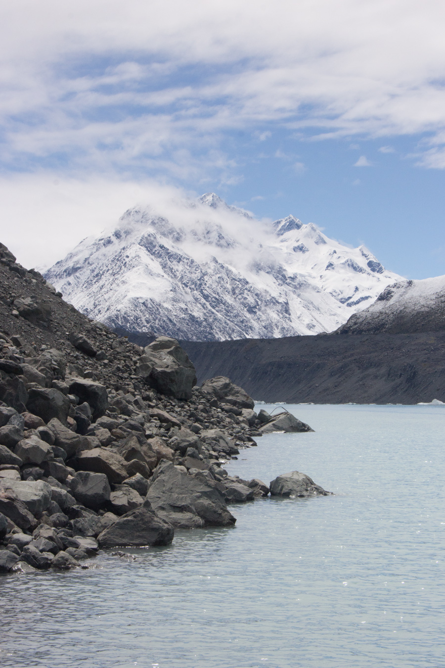
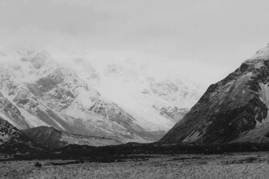
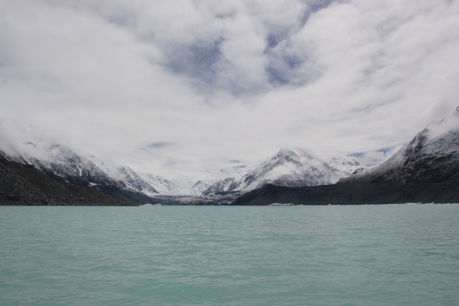
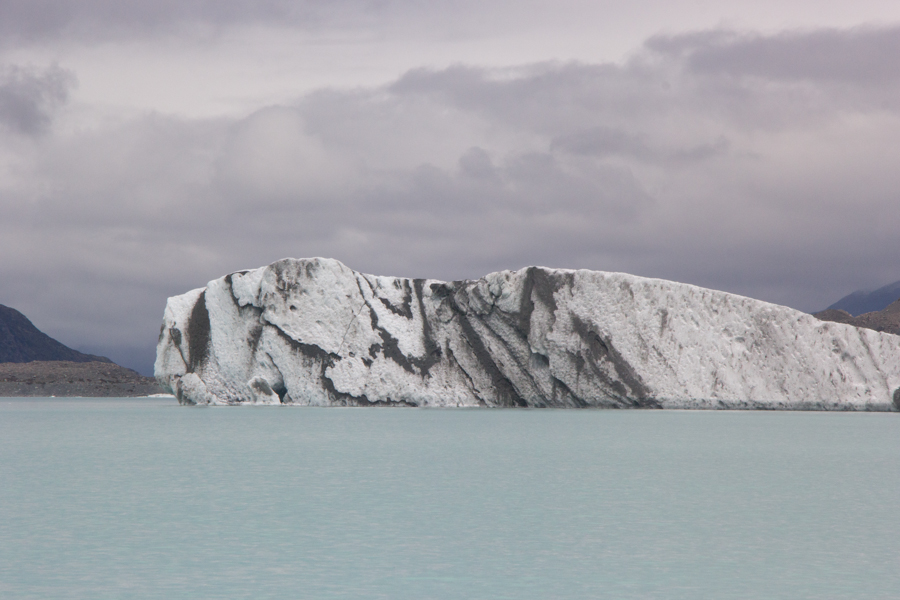
Tasman Lake and Mt. Chudleigh (2,966 m).
This was the day we would do our delayed glacial lagoon boat ride. It was spectacular! We are so glad we did not miss out on it entirely. We even got to see the mountain!
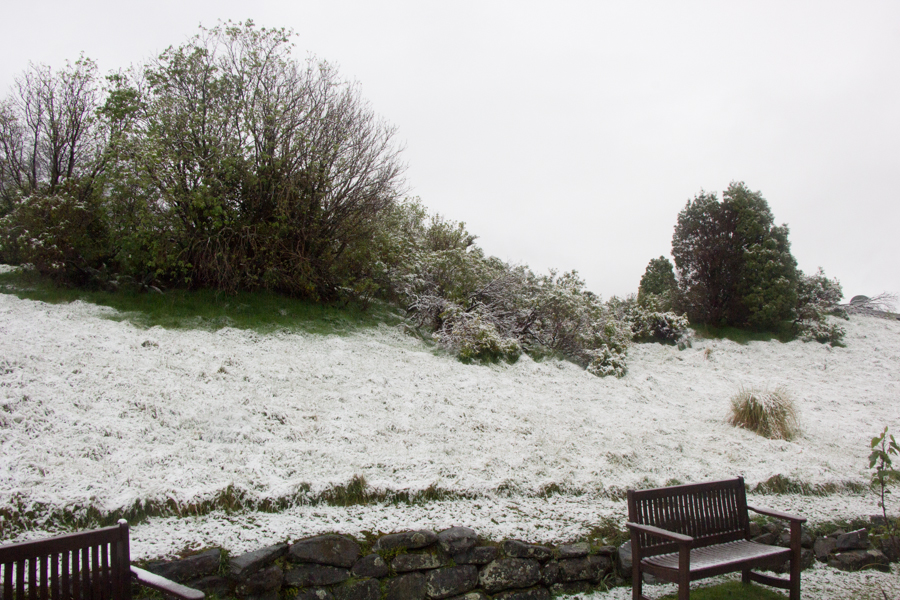
I mentioned that snow had been falling the previous night. We woke up to this view out of the back window of our room.
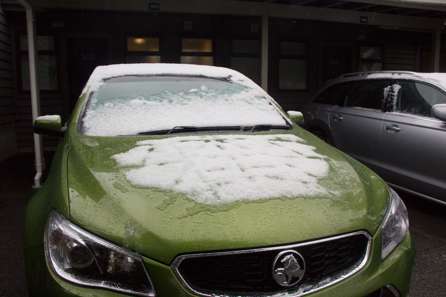
It was a good thing there wasn't too much snow on Fenway, because we certainly hadn't thought to ask for a snow brush!
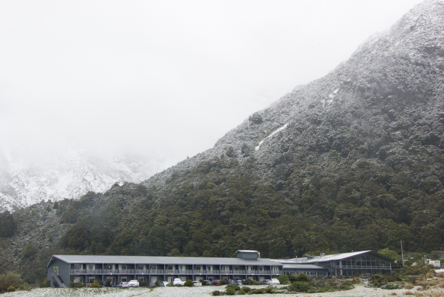
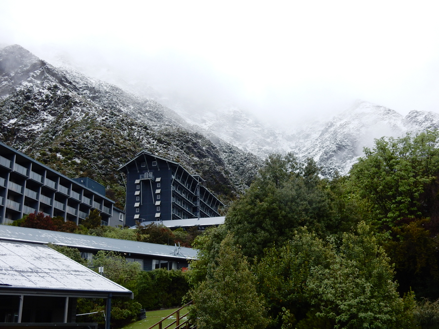
The Mt. Cook Lodge & Motels where we stayed, nestled in the mountains.
Eric's photo of the Hermitage, also nestled right into the mountains. Apparently the Chateau Tongariro had been similarly nestled, but we hadn't been able to notice.
Of course, we couldn't resist getting out of Fenway to take some pictures in this dramatic, snow-covered glacial valley. You should be able to see Aoraki/Mt. Cook in the distance in this picture, but it is shrouded by clouds.
I am particularly excited by this telephoto shot, and may enter it in a photo contest next year.

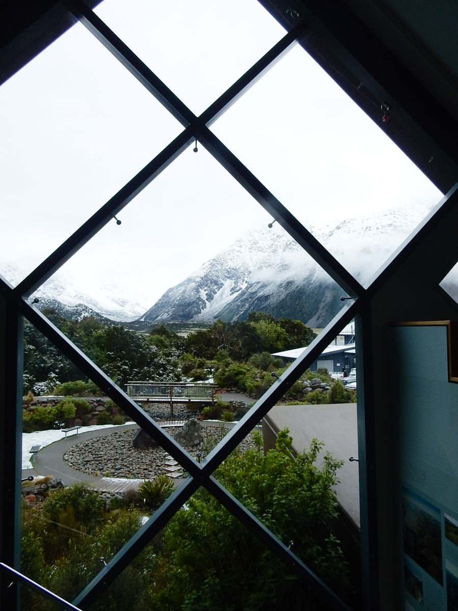
Eric's view out the window of the Visitor Centre.
Eric took a picture of the relief map at the Visitor Centre.

We had a very quick breakfast in the café at the Hermitage. New Zealanders copy the British habit of putting vegetables in a little pie. I think this is very civilized.
This is where we discovered the necessity of two often overlooked but extremely essential pieces of camera equipment: a good bag, and a pencil eraser. A few days previously, I had slid the zipper pull off the end of the zipper on the outside auxiliary pocket of my camera bag, the pocket in which I keep all the little things I need to reach for quickly, sunglasses, phone, passport, nasal spray, pen, chapstick, and, of course, lens tissues. I had had to find other, less easily accessible, places to store all of those things, and removed a bunch of not immediately essential camera items from the bag in the process. This meant that, when the contacts on my primary walkaround lens started to fail right before the glacier tour, I frantically had to ask the hotel, café, and gift shop staff for a pencil with an eraser. No one had one, and I had to run out to Fenway, pull out my suitcase, and try to find an eraser. Eventually, I did find one in a different pocket of the camera bag, and was able to fix the lens. But it was alarming!
Eric, meanwhile, had been having problems with his pocket Panasonic Lumix. But I had not only brought my old 2005 Rebel XT body as a backup for myself, I had brought my pocket Nikon Coolpix as a backup for him. The Coolpix is bigger than the Lumix, however, and didn't fit in his case. He had to buy another small bag at the gift shop.
Nevertheless, despite these adversities, we got on the bus, on time, both with functioning camera equipment. It would have been so easy for me to have replaced the zipper on my oh-so-important outside pocket, if only I had the opportunity to shop for a zipper. Not before returning home.
The glacier tour included a 1,500 m hike from the bus to the boat landing. Eric took my picture hiking along the trail.
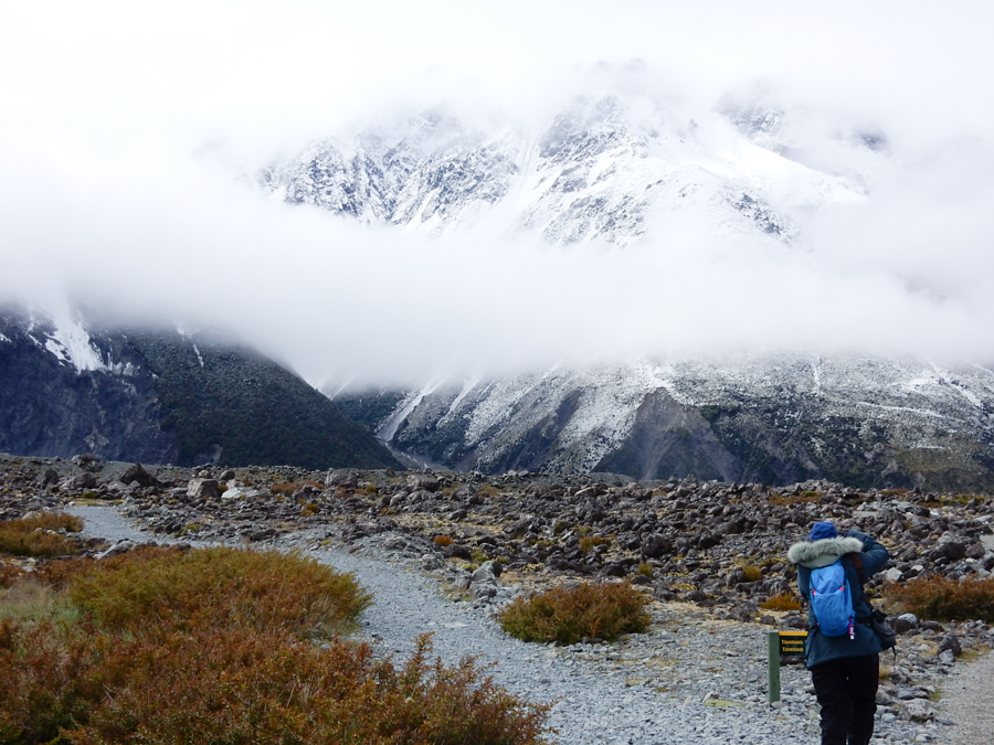
Our guide, Sean, had emphasized that it was very important that we hike the 1,500 m in no more than 20 minutes. We had thought that we would have to rush miserably and not take any pictures. However, for once, we were among the youngest people in the group, and it was other people who had trouble keeping up. There was a large group of Pakistanis, many of whom were in flip-flops. We had plenty of time to shoot all we wanted as they did a mountain tramp in their flip-flops. Fortunately, most of the snow on the track had melted.
Sean warned us not to touch this matagouri bush, as it had sharp thorns.

Matagouri and mountain.
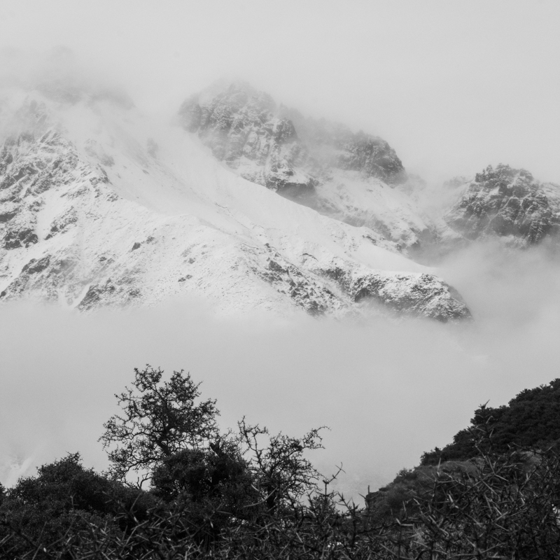
Sean told us that the mountain range around us, the New Zealand Southern Alps, was caused by uplift. We were near the Alpine Fault, where the Pacific Plate sometimes subducts under and sometimes slides along the Indo-Australian Plate. The subduction pushes the mountains up at a geologically incredible speed of seven mm/year! The Southern Alps are only about three million years old, much younger than most of the earth's other mountain ranges. By comparison, those amazing mountains in Pakistan, the Himalayas, are about 150 million years old.
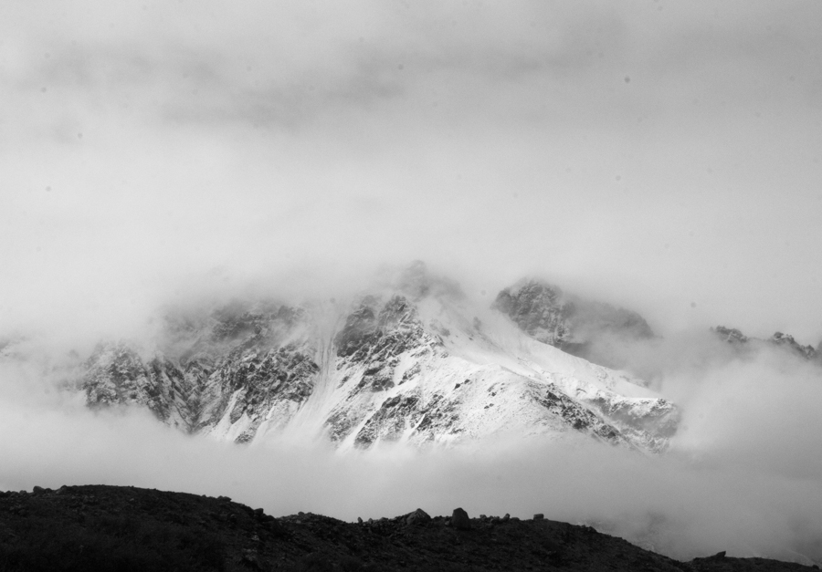
A mountain peeking out of the clouds.
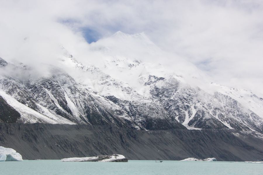
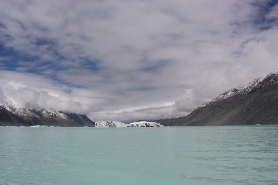
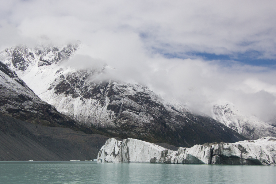
We came to Tasman Lake, the same lake we had visited the previous day.
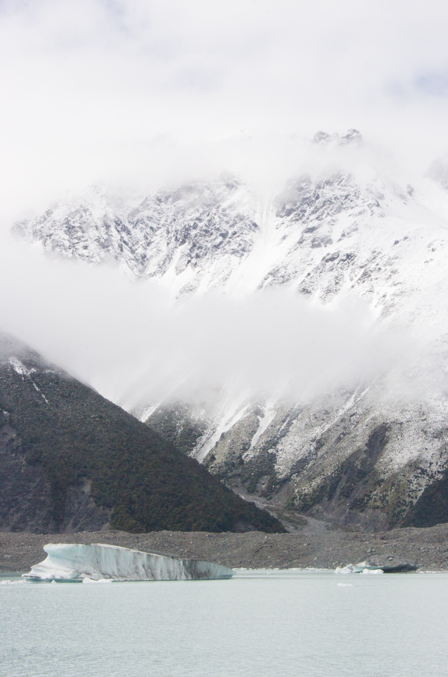
Eric's view of the lake.
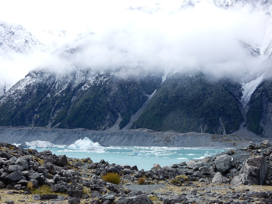
Sean told us that the blue color of the lake was caused by glacial rock flour. As the glacier moves over rocks, it breaks the smaller ones up into dust. The particles in this fine powder trap sunlight, but as the blue end of the spectrum is refracted and scattered more, we see the blue. This is the same action that makes the sky appear blue. Eric, apparently frustrated at trying to shop for all of my baking needs, begged me please not to ask him to try to find glacial rock flour at the supermarket.
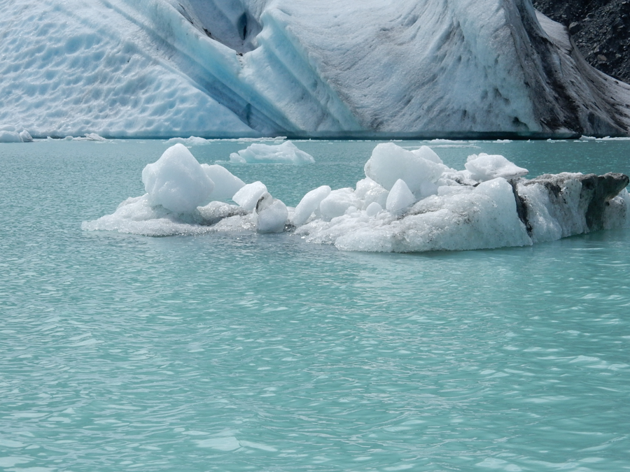
Here is a close look at the water.

We boarded these boats, specially custom designed for iceberg exploration. They are made of polyethylene.

The Tasman Glacier, largest in New Zealand. Sean told us that it was an alpine valley glacier.
We headed out among the icebergs.
Eric's view.
They brought us up close and personal with an iceberg.

Eric's view.
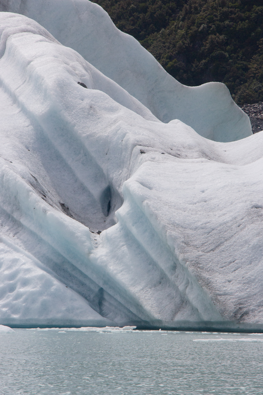
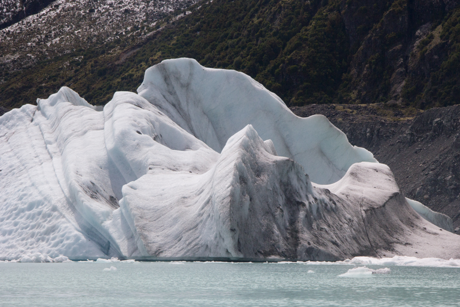
We explored this iceberg feature.
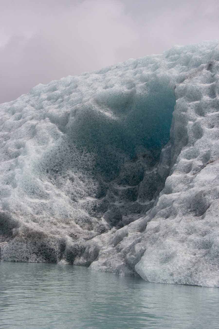
See the blue in the iceberg.
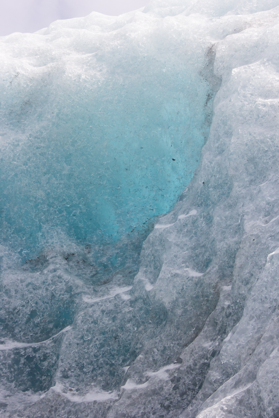
Sean explained that the blue color indicates that this part of the iceberg was recently underwater. This iceberg just calved off the glacier three days before, and apparently had turned over in the last few hours. The underwater parts of the glacier stay colder and remain bluer, and when the ice turns over and is exposed to the sun, it warms and loses the blue shade. We were lucky to see some blue.
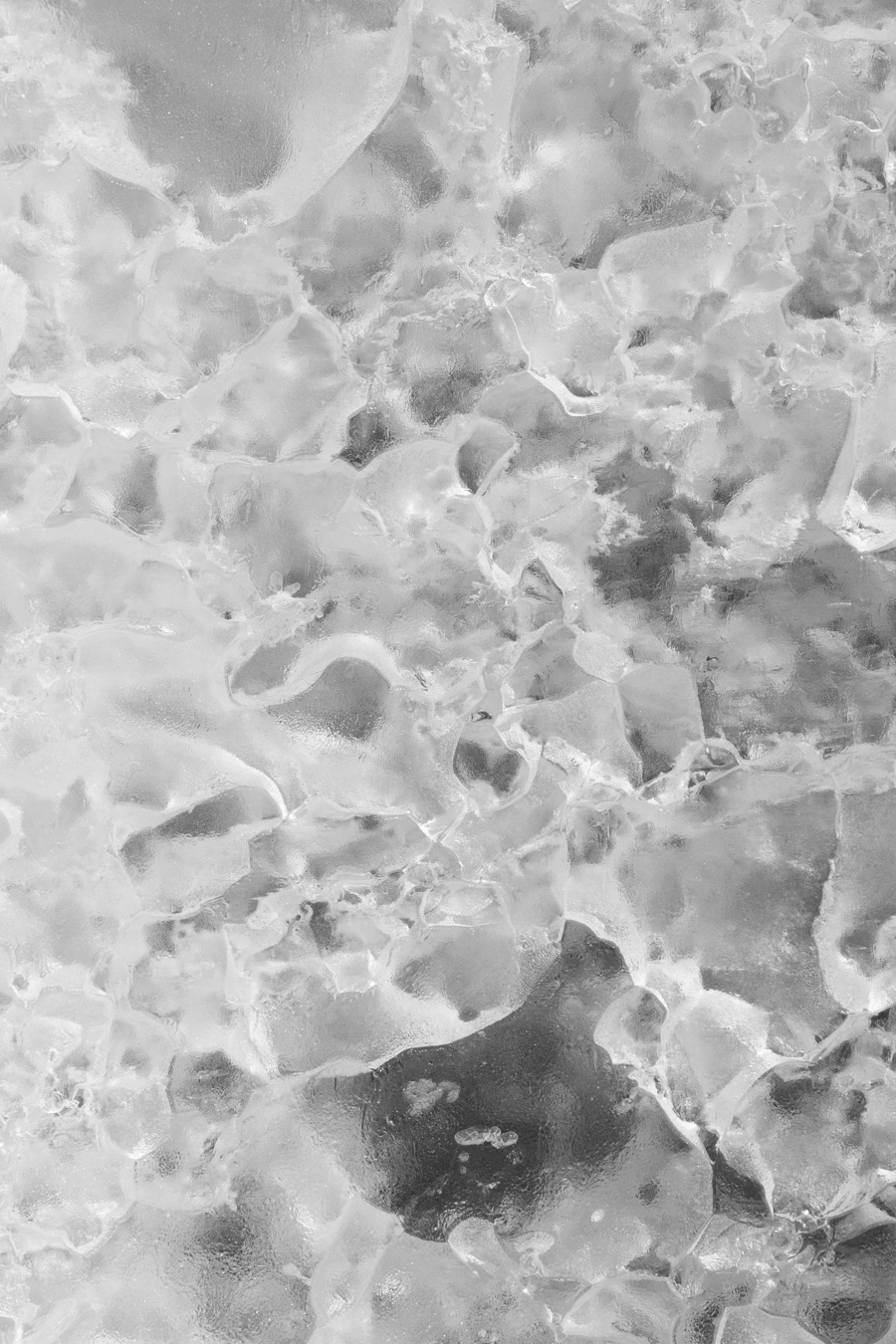
We got up close, so we could touch the ice crystals.
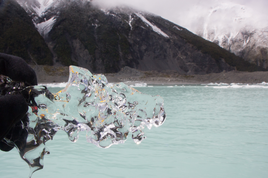
Our guides fished small pieces of ice out of the water for us to examine (and taste!).
Iceberg with boat for scale.

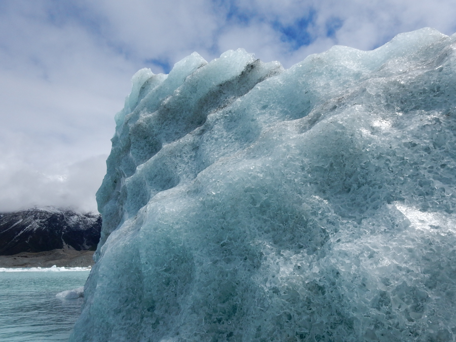
The icebergs were so beautiful.
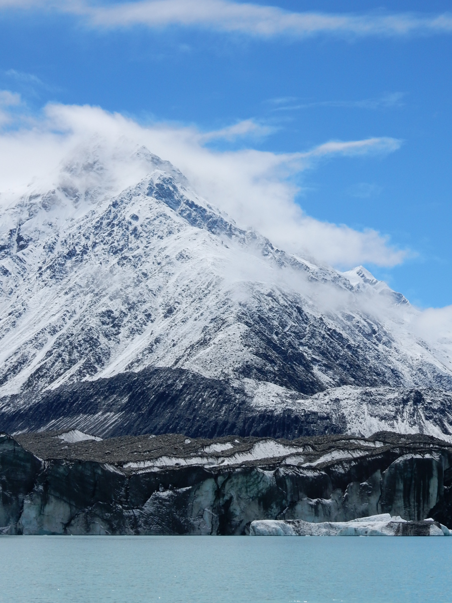
Du Faur Peak began to poke through the clouds. This peak is named for Freda Du Faur, the first woman to summit Aoraki/Mt. Cook, in 1910.
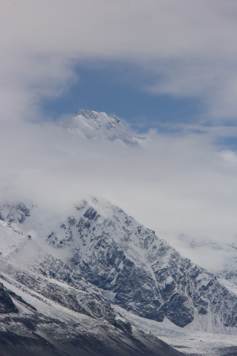
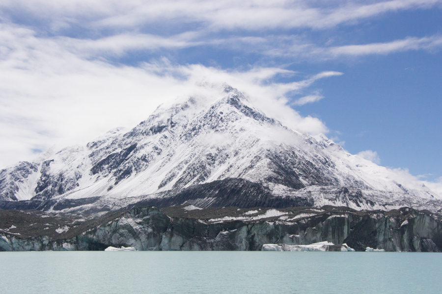
And, to our great excitement, both peaks of Aoraki/Mt. Cook itself appeared in the clouds!

We were so happy to get a glimpse of this amazing mountain, the tallest in New Zealand at 3,754 m.
Looking over an iceberg at Mt. Chudleigh.
An iceberg in its mountain scenery.

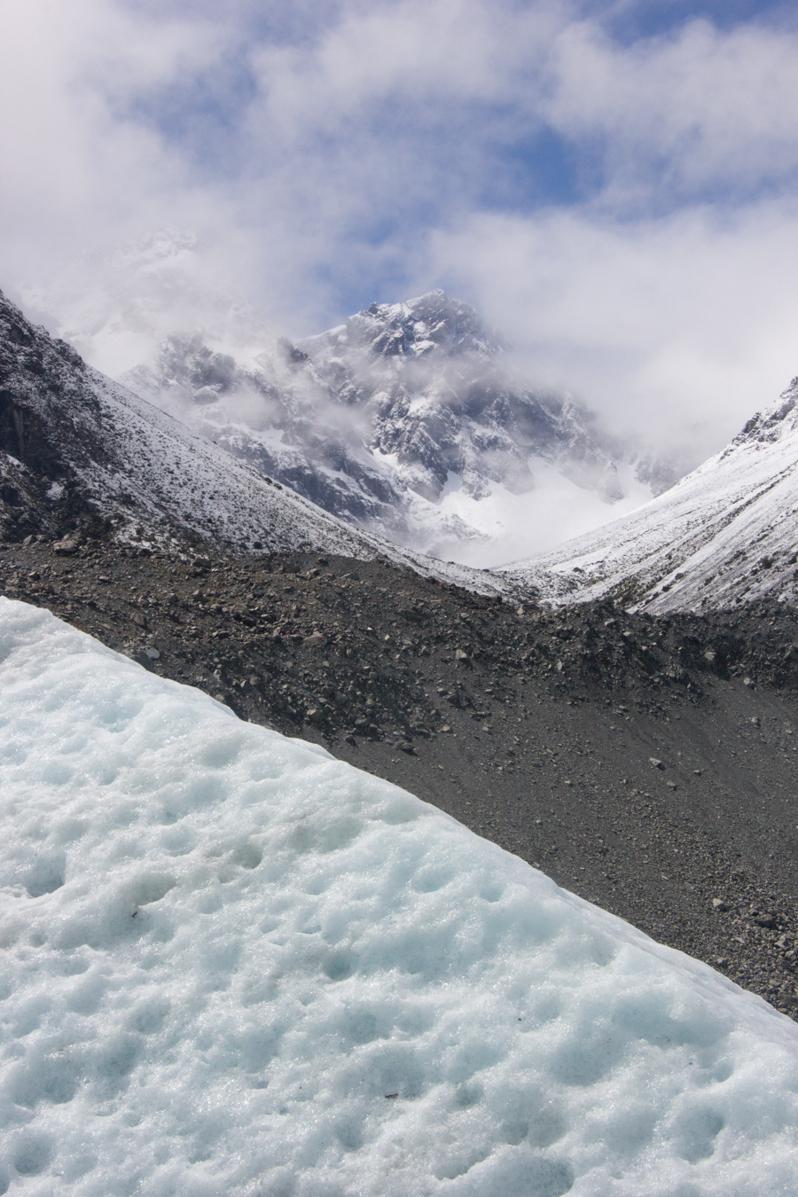
The terminus of the Tasman Glacier.
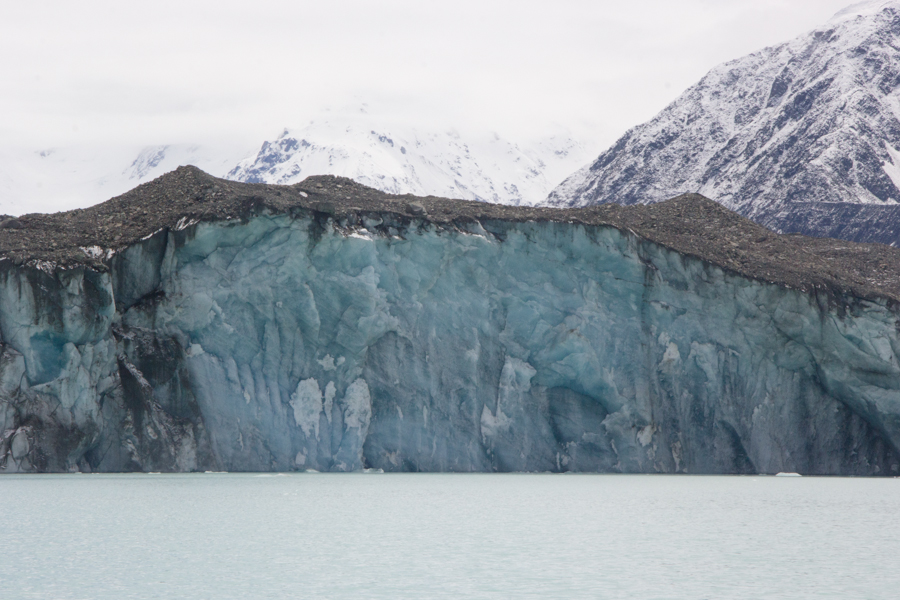
We were not able to get closer to the glacier than this, Sean explained. An ice shelf extended out from the glacier under the lake, and we were now at the edge of it. We all know about glaciers calving above the water, but Sean told us that they also calved underwater, in a process called basal calving. This was extremely dangerous to boats, we were told. Imagine that you were holding a rubber ducky under water and suddenly let it go. It would shoot up fast, right? That is what happens with basal calving. Even though it happens rarely, you can't hear any sound to predict it, and it could happen at any time. They can't risk driving boats over the underwater ice shelf.
Looking south across this beautiful alpine lake.
Mt. Chudleigh.
Eric's view.
Sean took our picture in front of the mountain.

The patterns in the icebergs were so beautiful.
Iceberg with mountain.
We were so excited by this incredible tour. It had been far more beautiful than we expected.
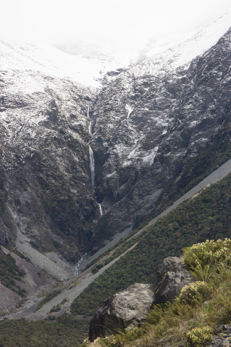
Waterfall on the hike back to the bus.
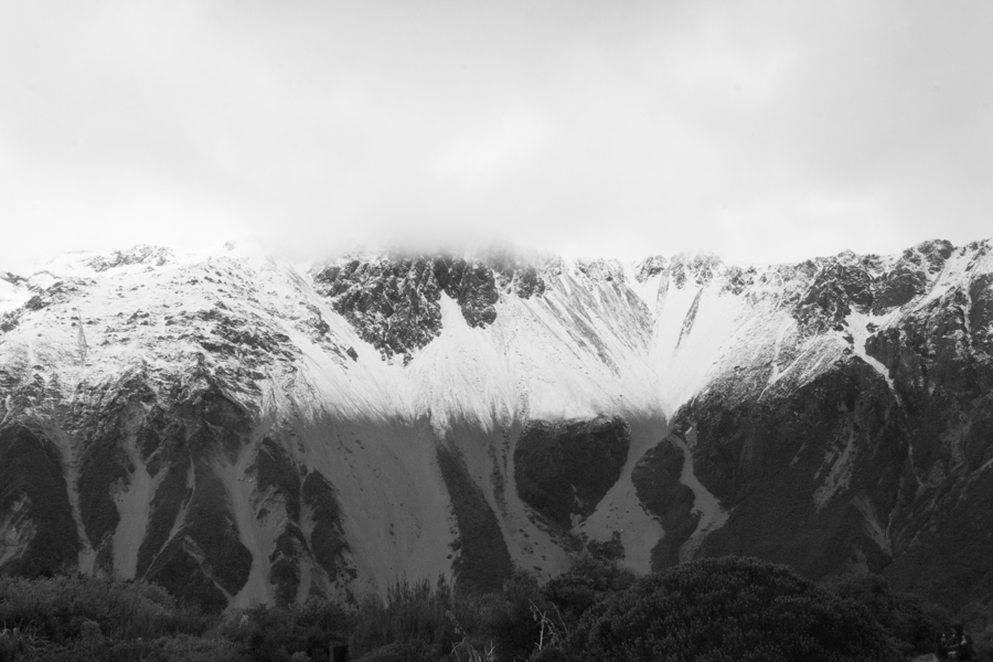
Back at the Hermitage, we were impressed by the dramatic line where the snow ended. That is not light and shadow; it's just snow and no snow.
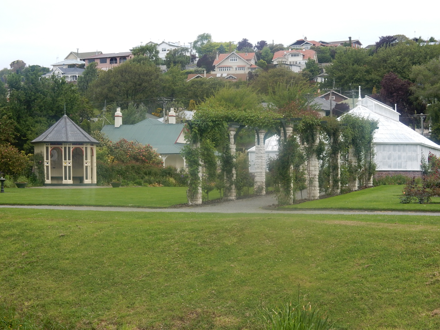
We still had to drive almost four hours to our lodging for the night, in Dunedin. We stopped in Oamaru for a picnic. Eric took a picture of the very civilized public gardens. They even had flush toilets.
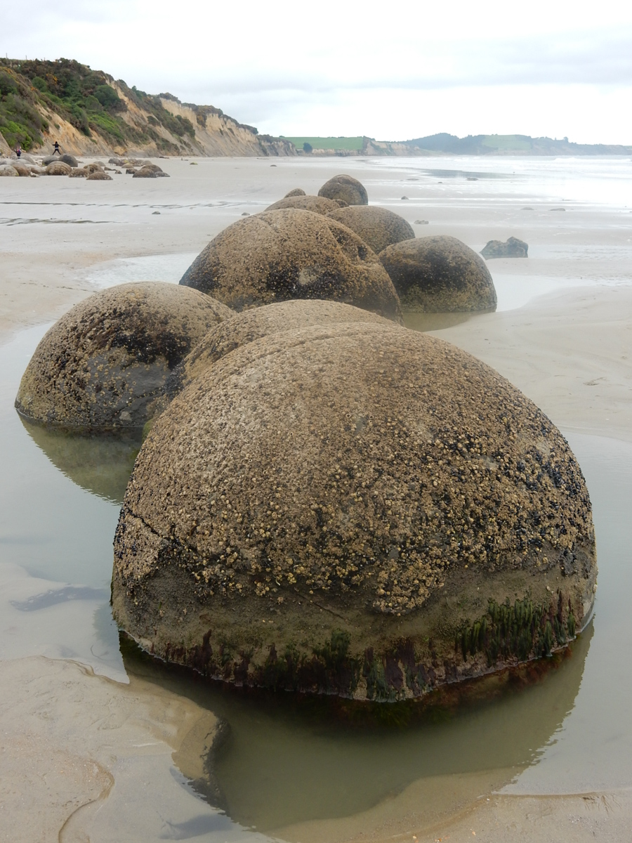
We made only one sightseeing stop on the way to Dunedin, for the Moeraki Boulders.

These very spherical boulders are concretions that started to form about 55 million years ago from pebbles and shells buried on the sea floor. Lime deposits formed slowly and evenly around these pebbles and shells, creating the spherical shape. Eventually the sea floor was uplifted by the same process that created the Southern Alps. Then the sea eroded the cliff edge, freeing the boulders from the softer rock around them.
Eric's view.
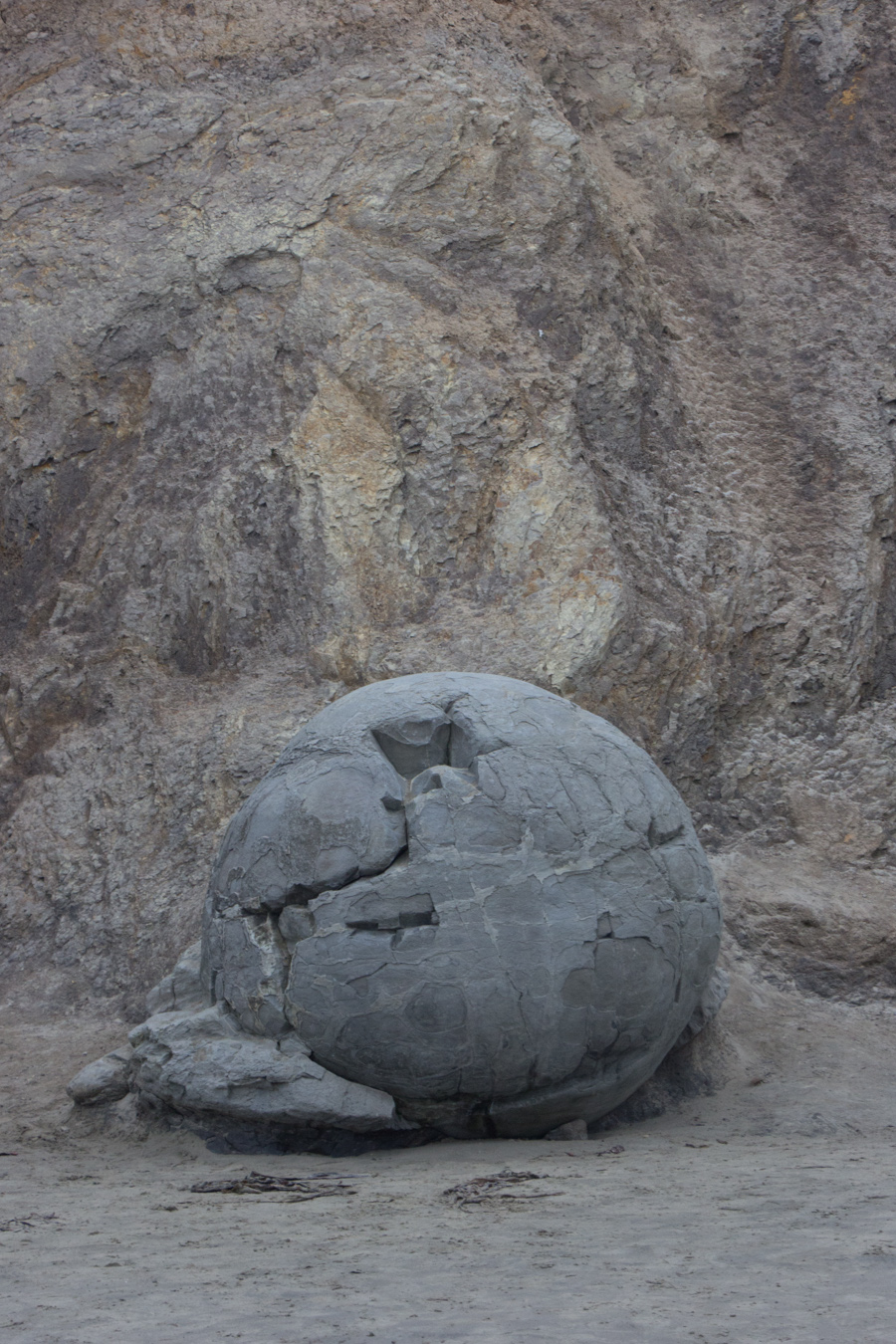
A particularly interesting boulder.
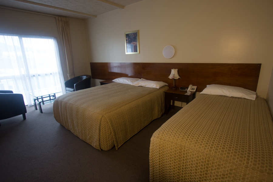
We arrived at our lodging at the Victoria Hotel in Dunedin at about 19:15, not too terribly late. Our room was nondescript but serviceable.
There was a restaurant on site that served peri-peri (pepper) chicken. The desk clerk offered to bring it to us in our room free of charge. Considering how much time we had been spending waiting for food to be served to us, the idea of being able to sit in our room with free wi-fi while waiting for it to be brought to us held great appeal. The spicy chicken was great for my nose, as I was finally coming down with the cold Eric had caught at Tongariro. (Thank you, American voters, for stressing me out on my vacation.) It would have been very relaxing and comfortable, except that the wi-fi was down for the first few hours.
On to the Otago Peninsula.