Grand Staircase-Escalante National Monument--Cottonwood Road, Grosvenor Arch, and Hackberry Canyon
18 May, 2018
Hackberry Canyon.
Cottonwood Road (48 km/30 mi) is one of the few roads in Grand Staircase-Escalante National Monument that is sometimes passable without a Jeep. While we felt that we could have driven it in Sydney the Civic, the ranger in Cannonville insisted you needed a car you could get your entire body under. This is why we had purchased Mather the Crosstrek.
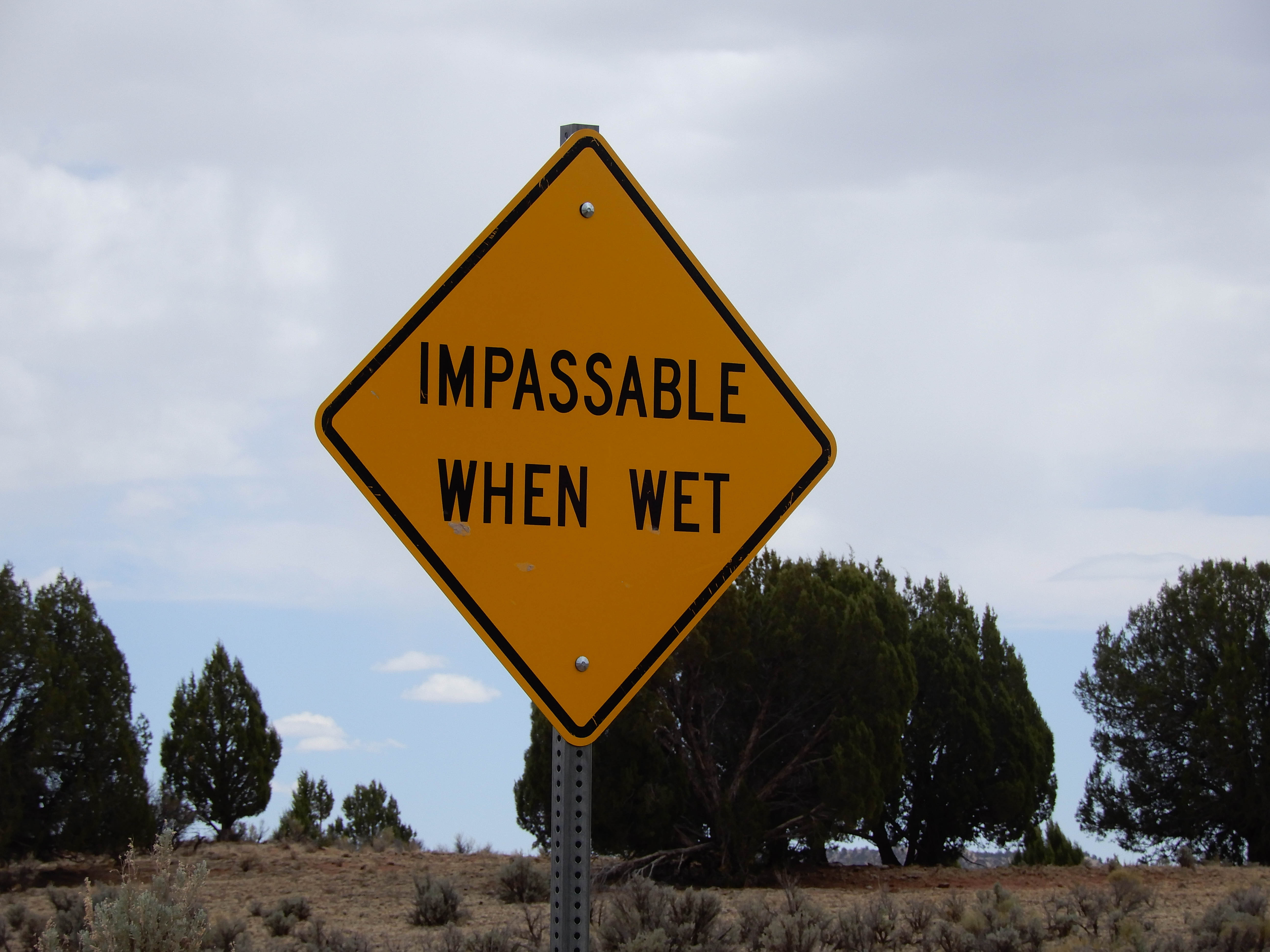
Cottonwood Road is sometimes impassable even with a Jeep, because 8 km/5 mi north of the intersection with US 89, it crosses a bed of gumbo clay, or bentonite. Bentonite is a thick, mucky combination of volcanic ash and sea floor mud that swells when it gets wet. Manufacturers of shampoo, lotion, and, um, chocolate and yogurt, mine bentonite and use it to thicken their products. [SOURCE: Geology Road Guide: Cottonwood Canyon by Janice Gillespie with Christa Sadler] Photo by Eric.
One of the first stops on Cottonwood Road is Grosvenor Arch, 17.1 km/10.6 mi from the north entrance to the road in Cannonville, Utah. This place could be accessed without four-wheel drive by relatively adventurous drivers.
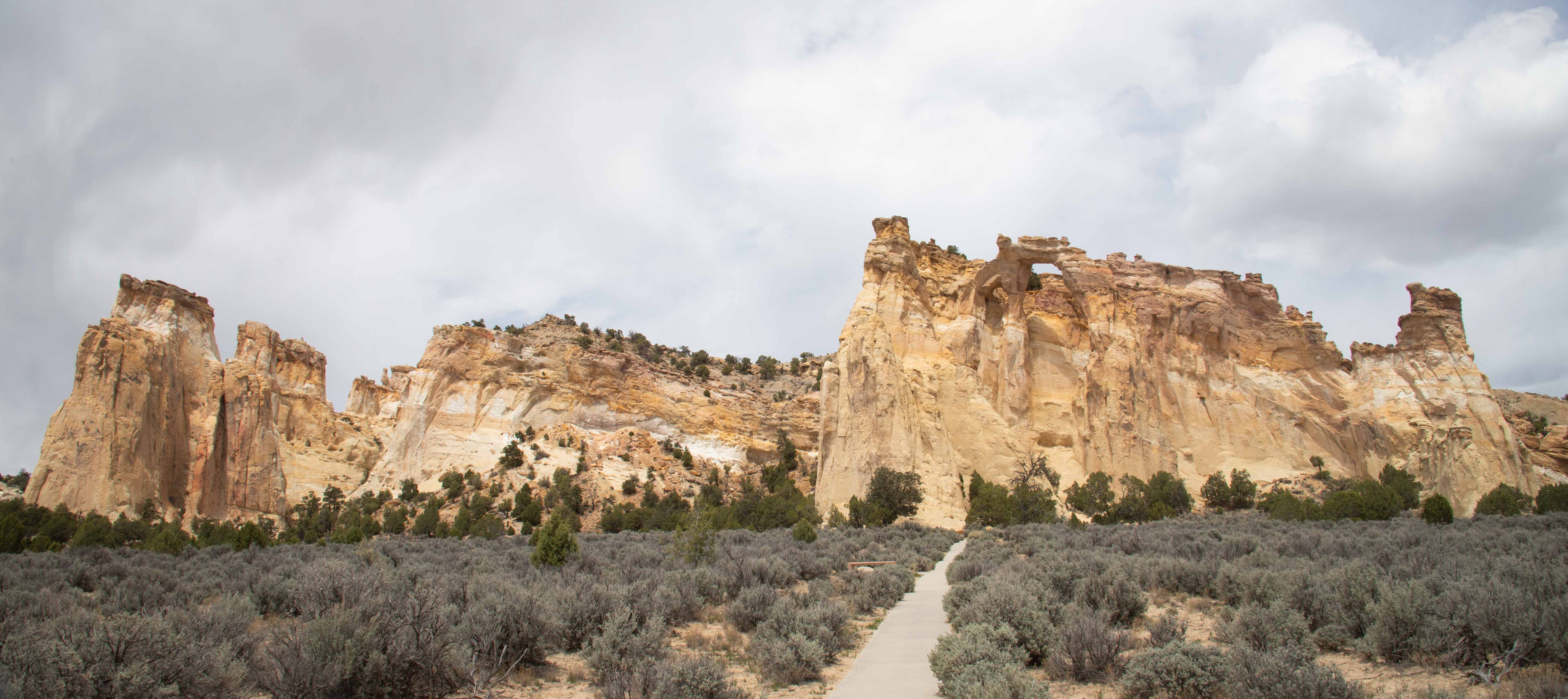
Eric's picture of grand Grosvenor Arch.
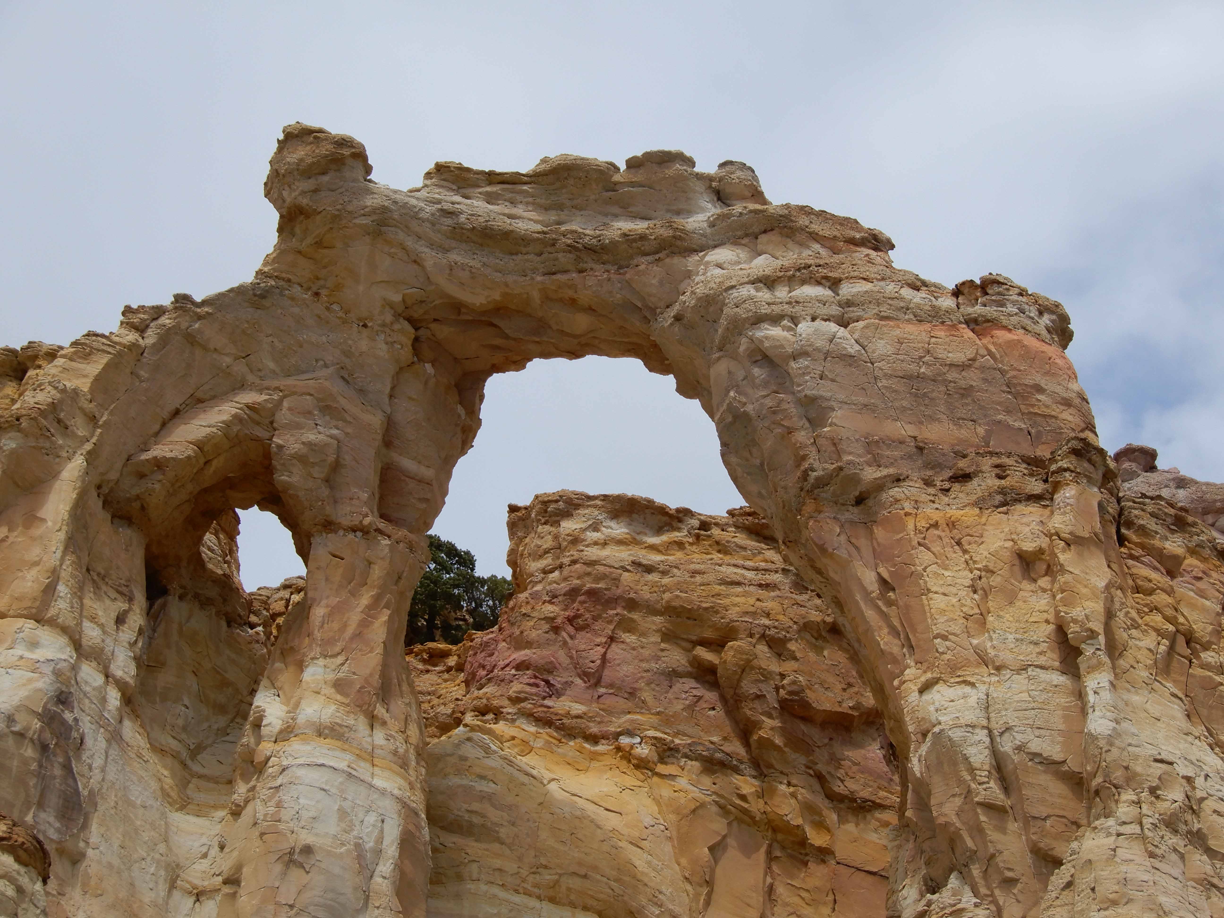
Grosvenor Arch is named for Dr. Gilbert Grosvenor, founder of the National Geographic Society (although some of my readers may recognize the Grosvenor name from other contexts). The arch is formed because it is at the junction of two rock formations, the 165 million-year-old Henrieville Sandstone and the 95 million-year-old Dakota Formation. The Henrieville Sandstone was significantly eroded by wind and water before the Dakota Formation was deposited. Later, water entered cracks between the formations and repeatedly froze and thawed, causing blocks to fall out, forming an arch. [SOURCES: BLM interpretive sign and Geology Road Guide: Cottonwood Canyon by Janice Gillespie with Christa Sadler]
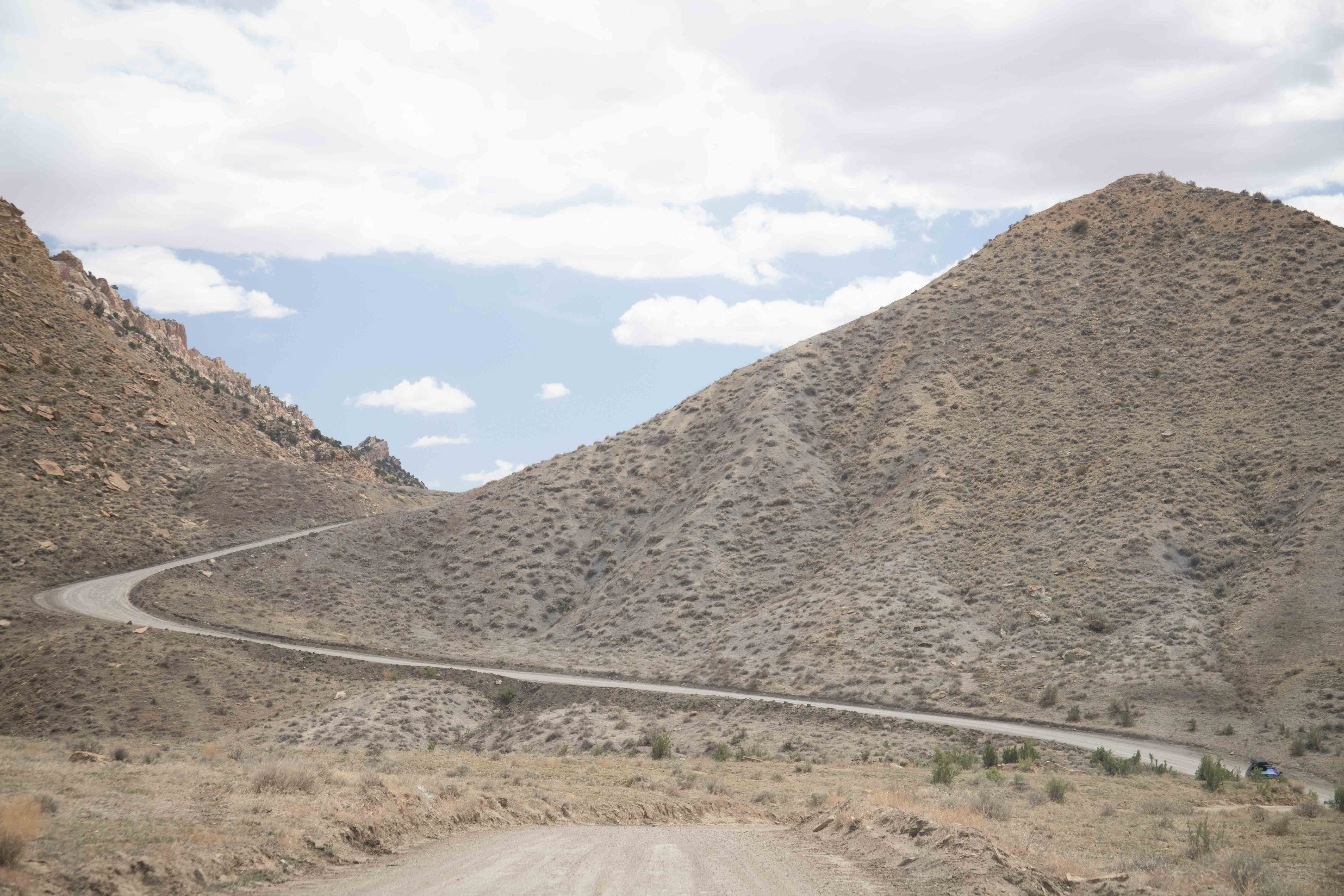
The drive along Cottonwood Road was so impressive that I took some pictures out of Mather's windows. This area is called the Cockscomb, because the ridges reminded people of a cock's comb.
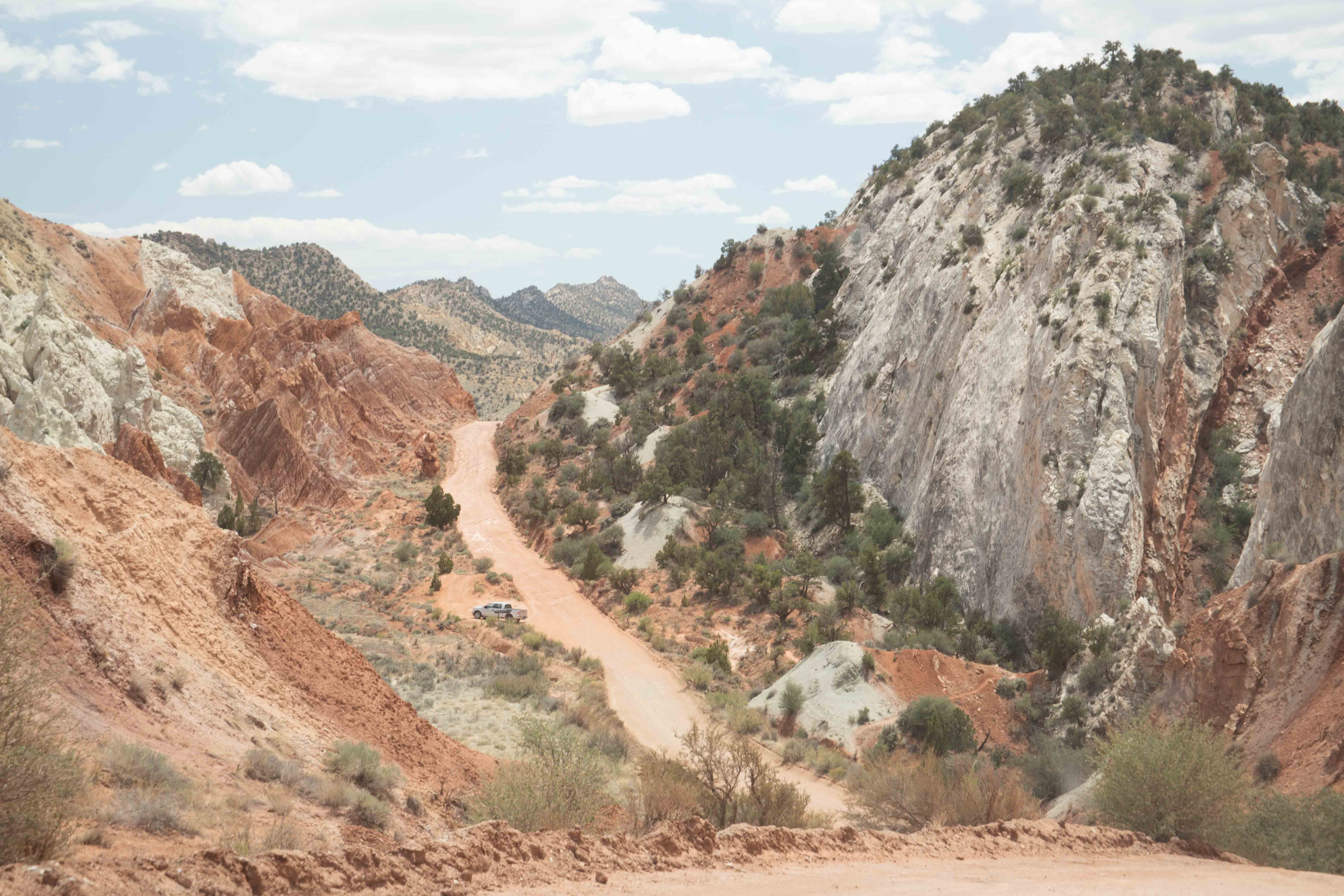
The road went through the floodplain of the Paria River. The road was closed due to a flood in 2007 and reopened in 2008 after an engineered stabilization project. [SOURCE: Geology Road Guide: Cottonwood Canyon by Janice Gillespie with Christa Sadler] Nature is always trying to undo any changes we make.
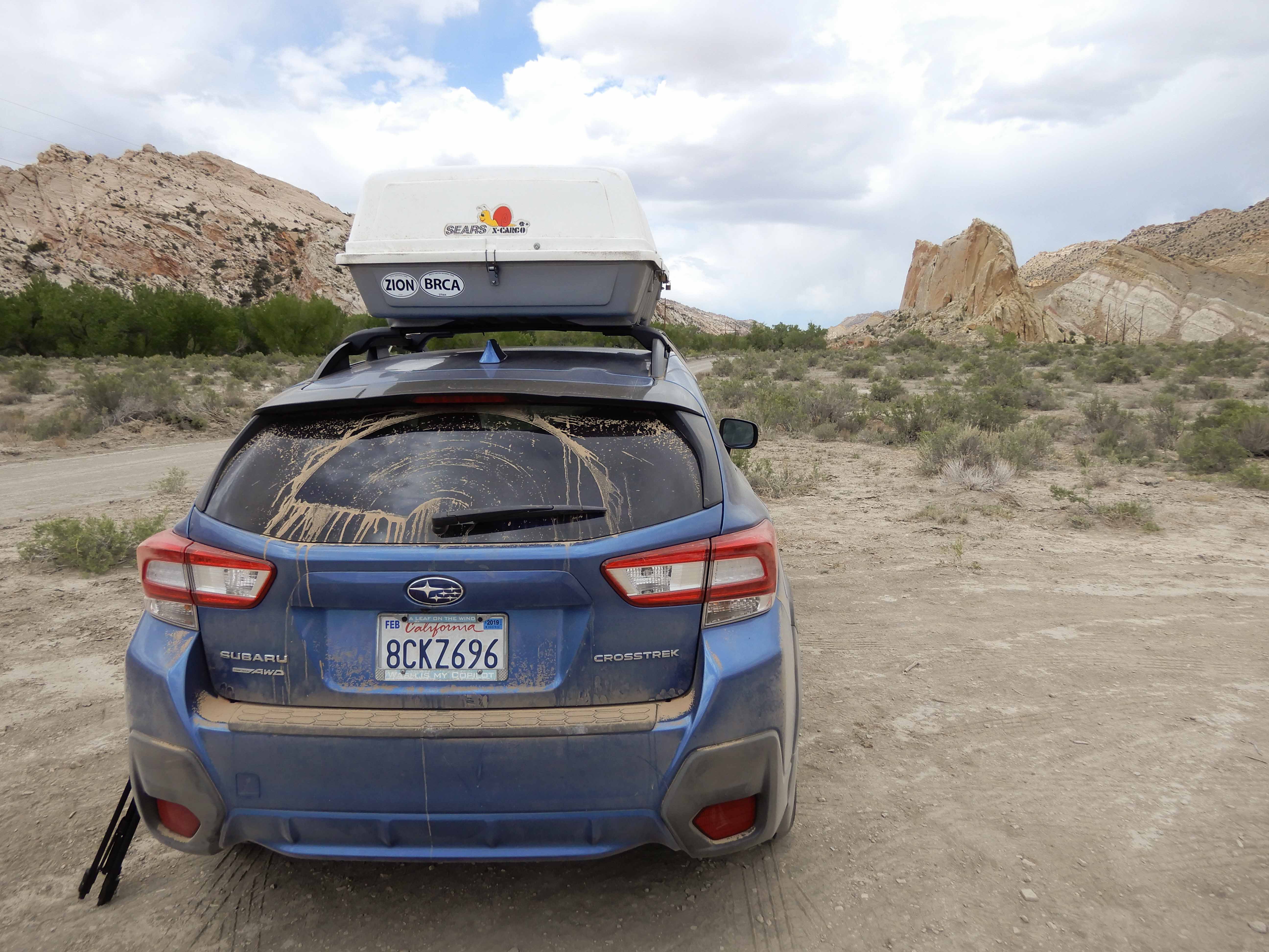
We stopped at our primary destination for the day, the trailhead for Hackberry Canyon. Eric took a picture of all of the dirt on Mather. He has less than 8,000 km/5,000 mi on his odometer, and yet he appears very well used.
We were looking for a place called Yellow Rock, which just sounded fantastic in Photographing the Southwest: Volume 1--A Guide to the Natural Landmarks of Southern Utah by Laurent Martres. However, the directions were fairly nonspecific and did not include GPS coordinates. After looking around for it for a bit, we decided just to hike through Hackberry Canyon, as that also sounded marvelous and was much more straightforward to find.
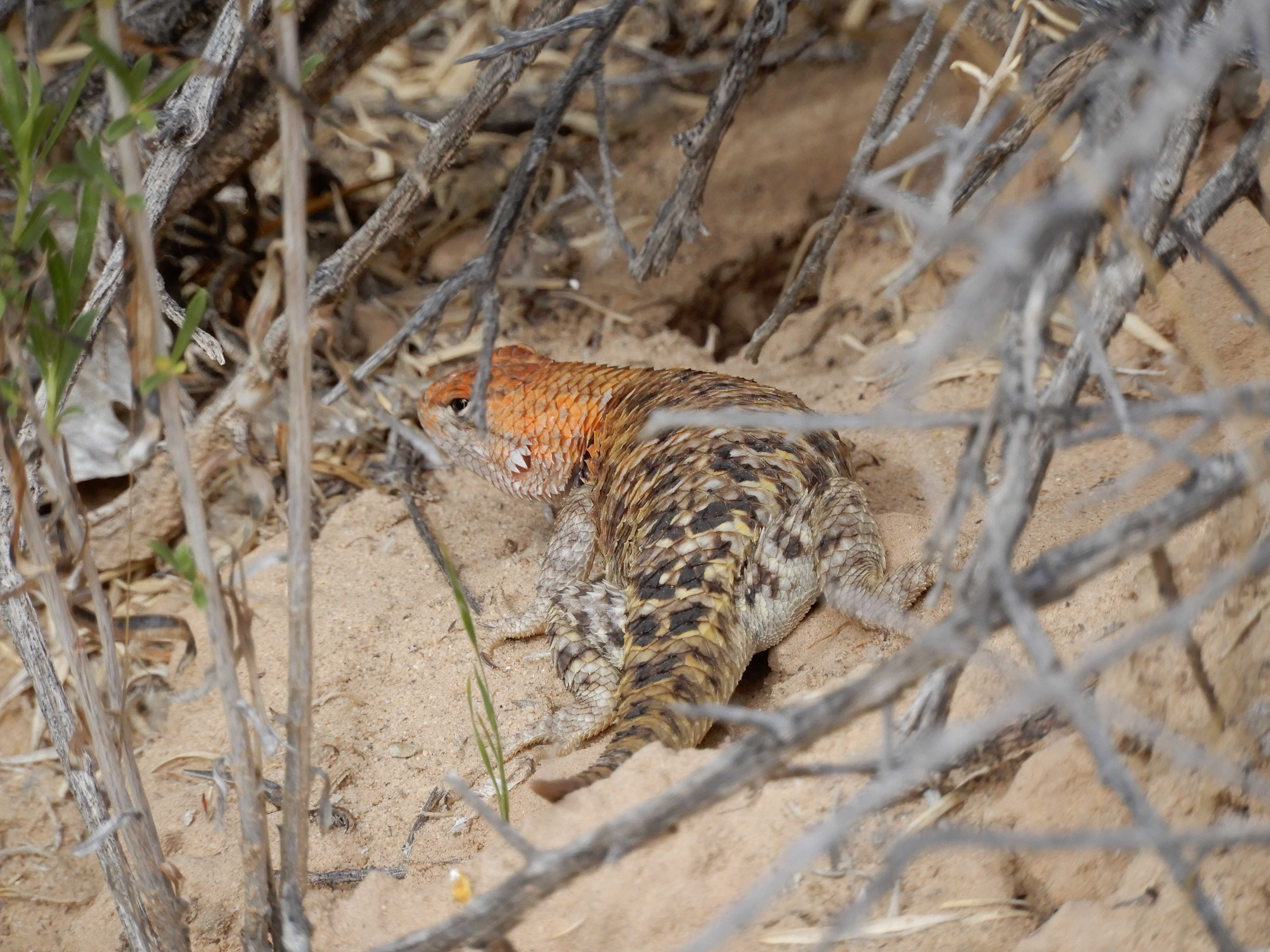
Before we set out on the trail, we came upon a group of people examining a Desert Spiny Lizard. Photo by Eric.
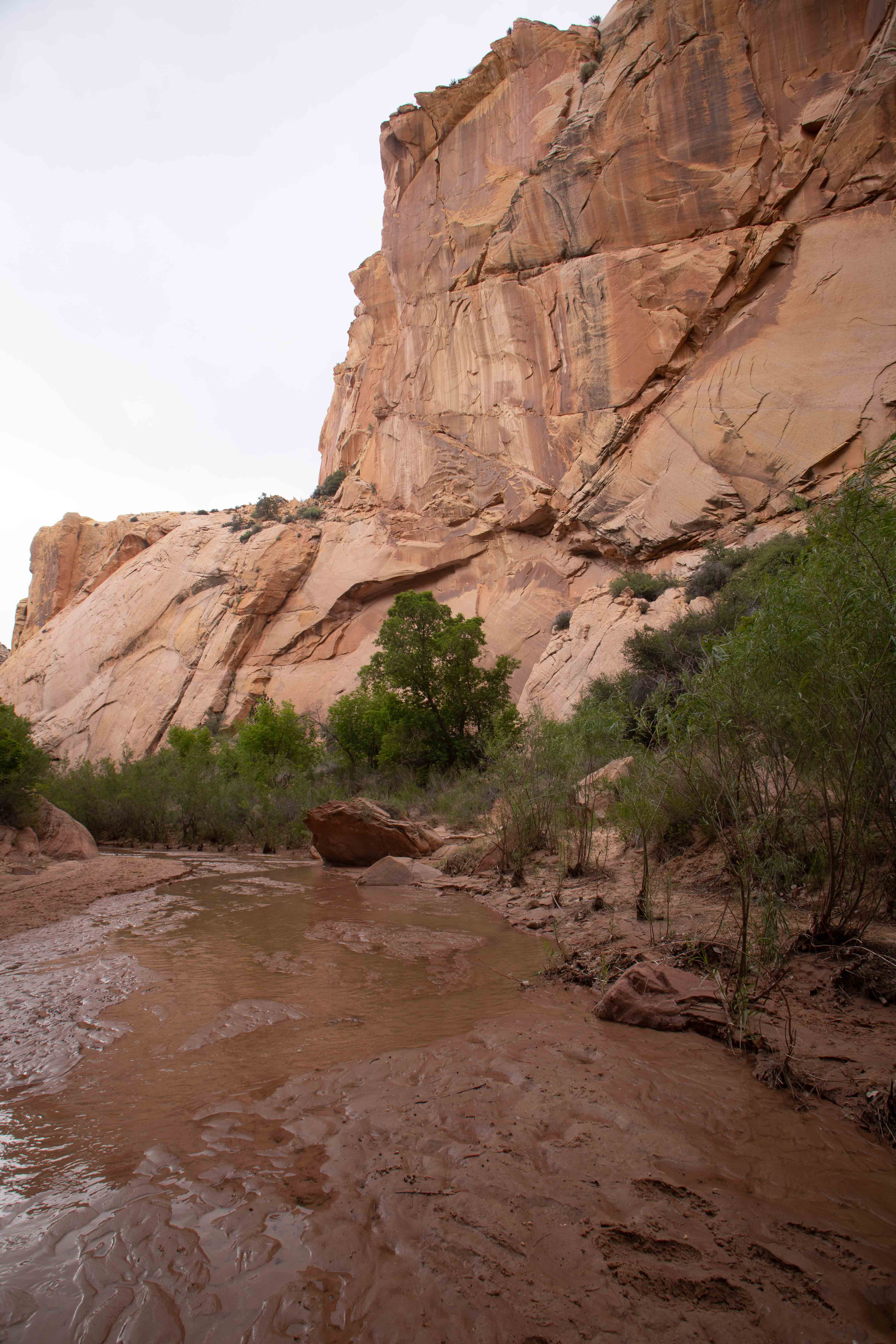
Eric took a picture as we headed into the lovely canyon. It wasn't as impressive as Zion, but it had only a few other people.
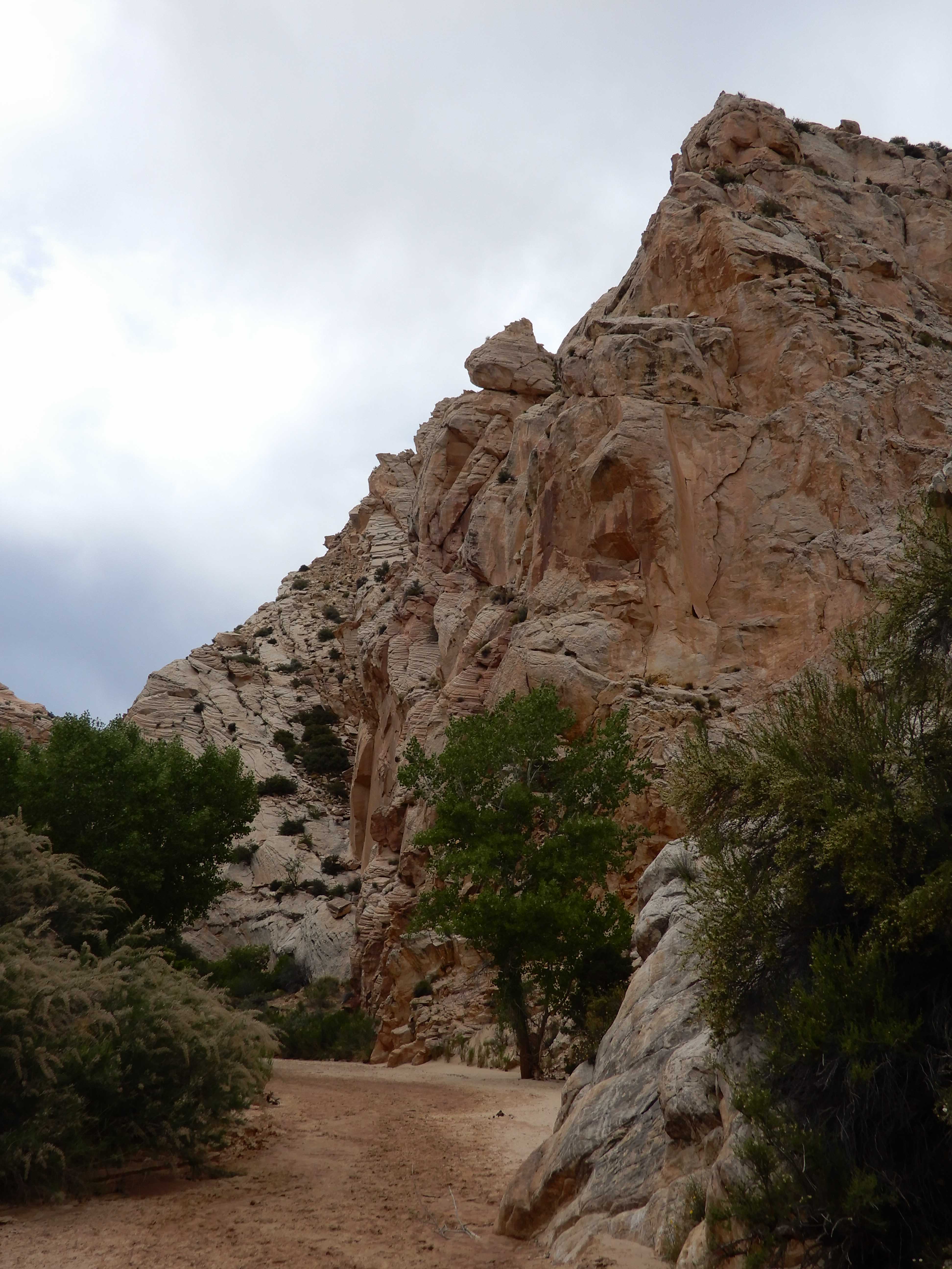
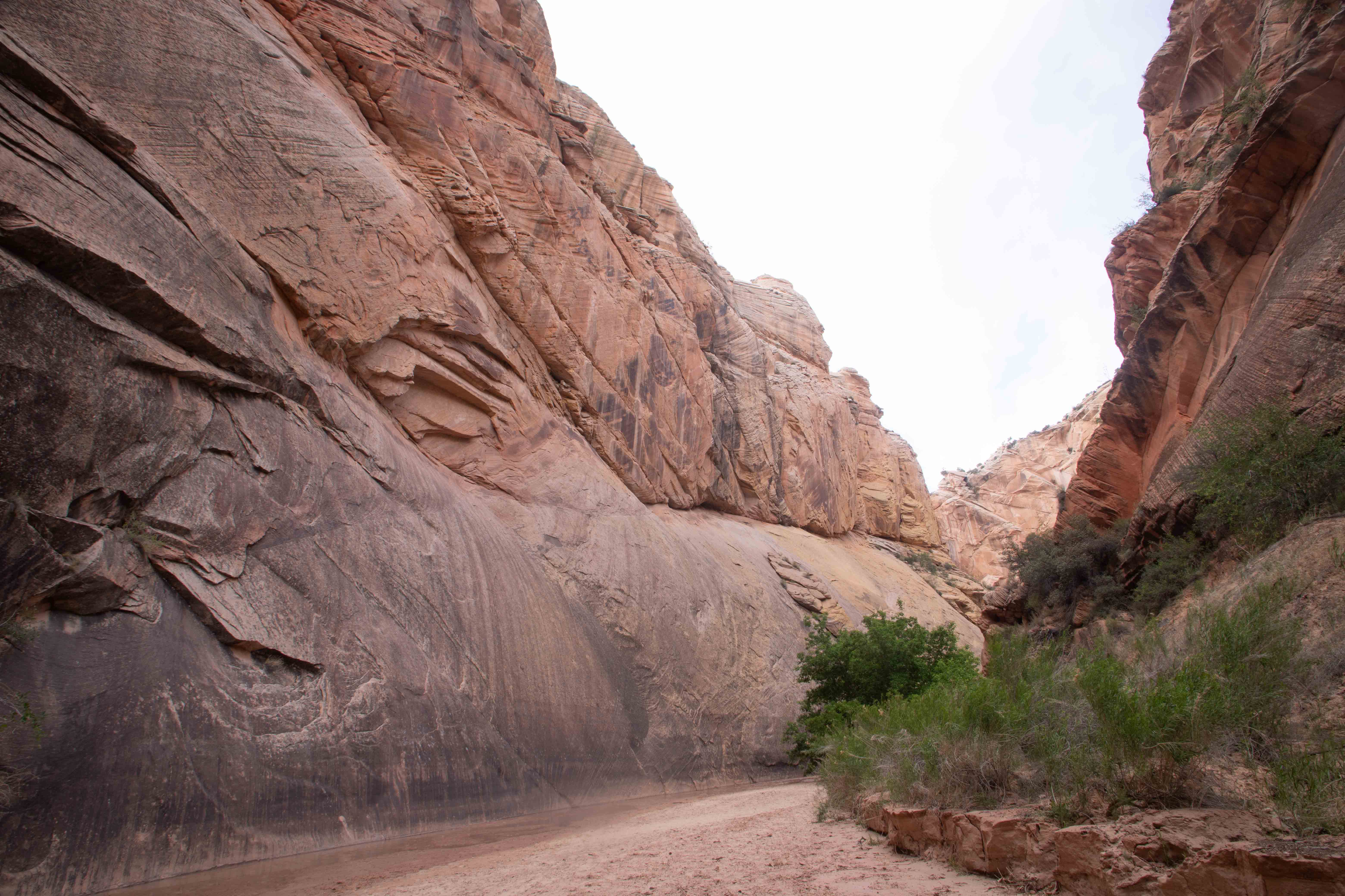
Steep walls of Hackberry Canyon.
Eric also admired the steep walls.
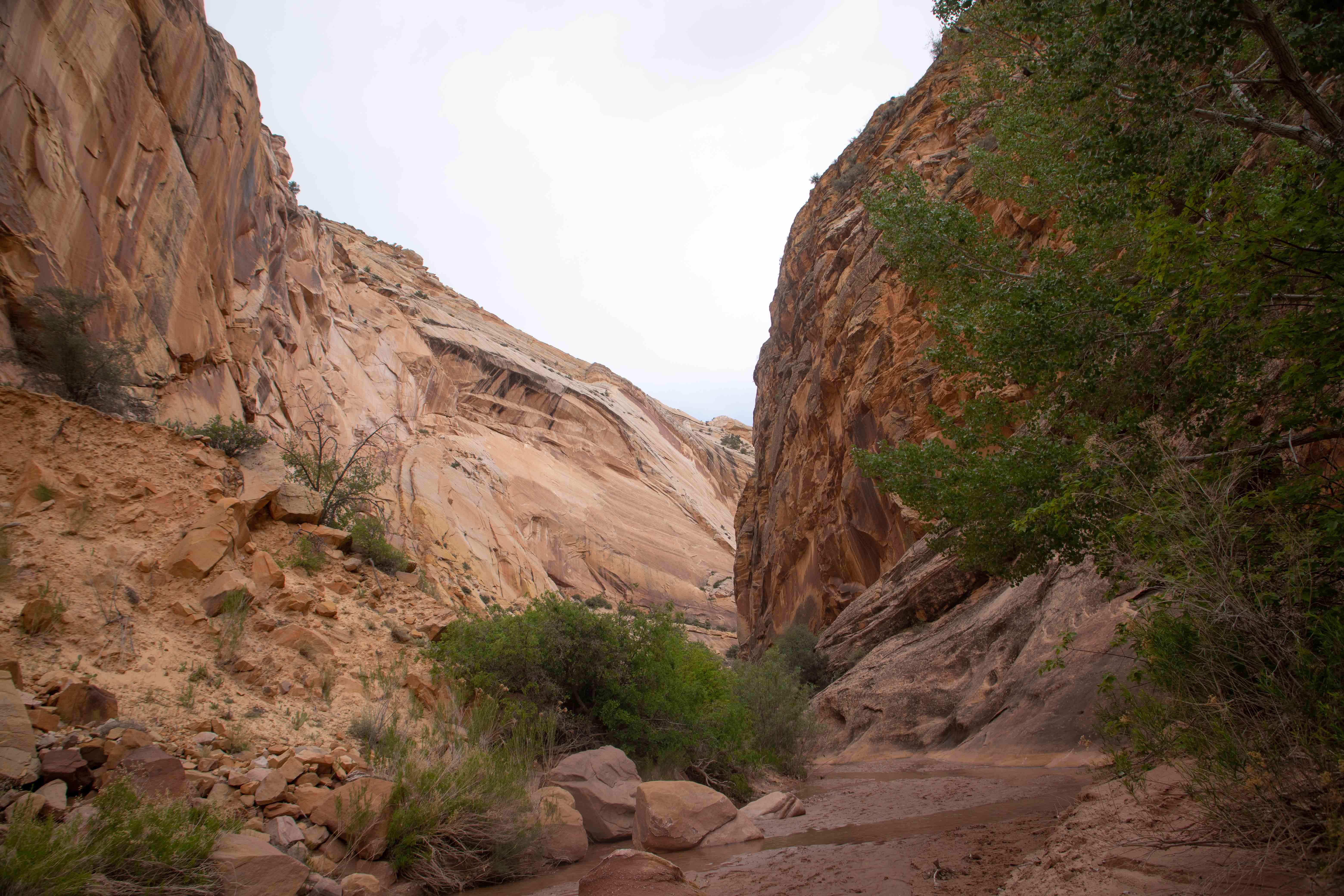
Eric took a picture of me walking through the canyon. I think it's too wide to be called a slot canyon; the geology guide called it a "narrows."
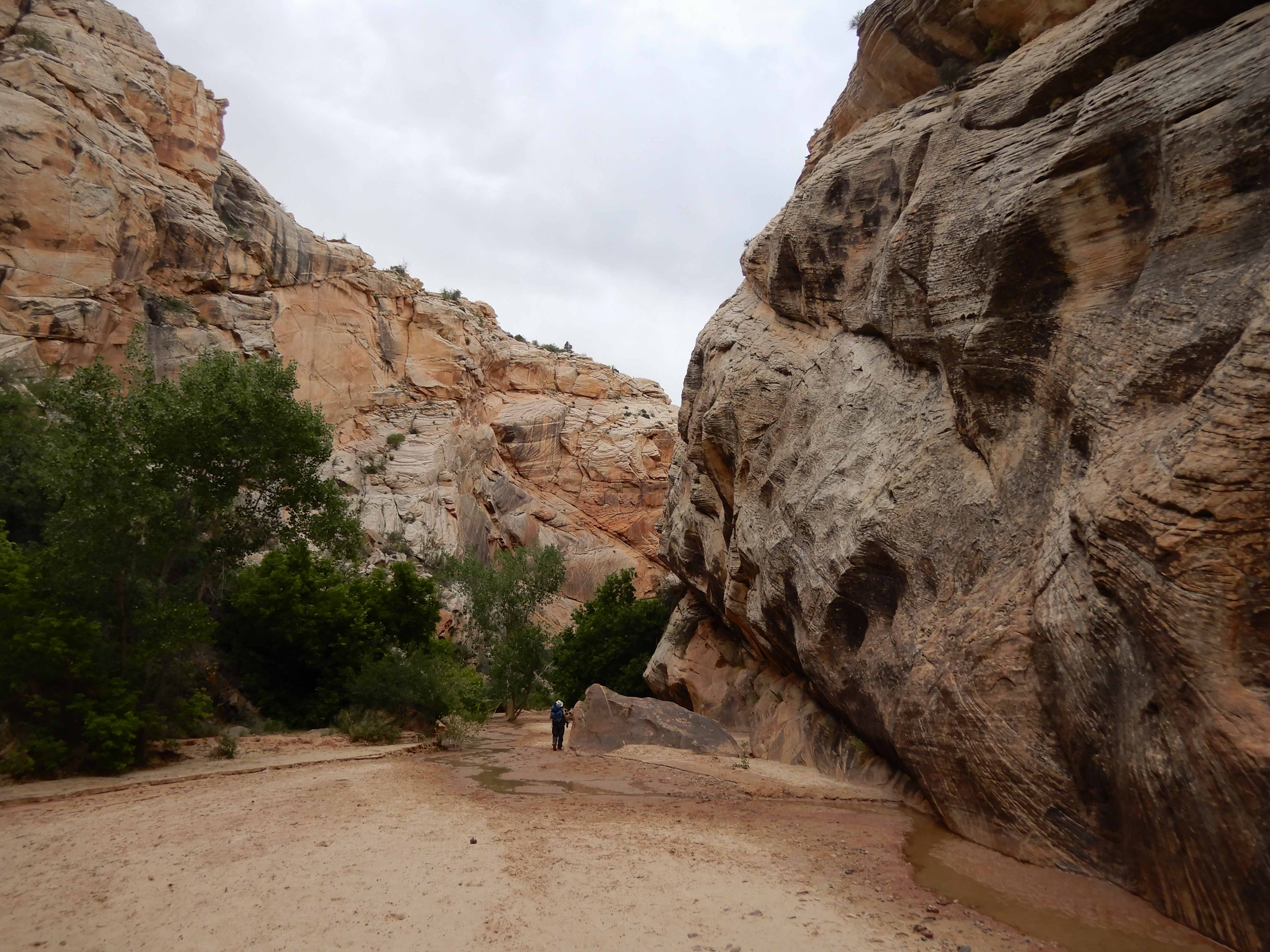
As we walked deeper into the canyon, the floor became wetter, and we started sloshing through puddles. Thank goodness for boots. I could see now why hikers find the Narrows in Zion so much fun, and it made me a little bit regretful that we had skipped that. Photographing the Southwest: Volume 1--A Guide to the Natural Landmarks of Southern Utah by Laurent Martres describes hiking the Virgin Narrows with great delight, calling it an "indelible experience" and saying that being immersed in the Virgin River "often up to your knees and sometimes higher...contributes immensely to the high fun factor of this great hike." However, the book goes on to describe how cold the water is and how it's good to do this hike in a dry suit. Where I really gave up, though, is where he talked about how cumbersome it was to bring your camera and tripod into the Narrows: "After a few images, however, you'll get the hang of it: dump the trekking poles, remove the backpack, deploy the tripod, attach the camera, compose and shoot and then repeat the whole maneuver backwards." Uh, yeah. We did the Watchman hike instead. But it was good to get a little taste of hiking through wet narrows here in Hackberry.
It was a lovely, peaceful place.
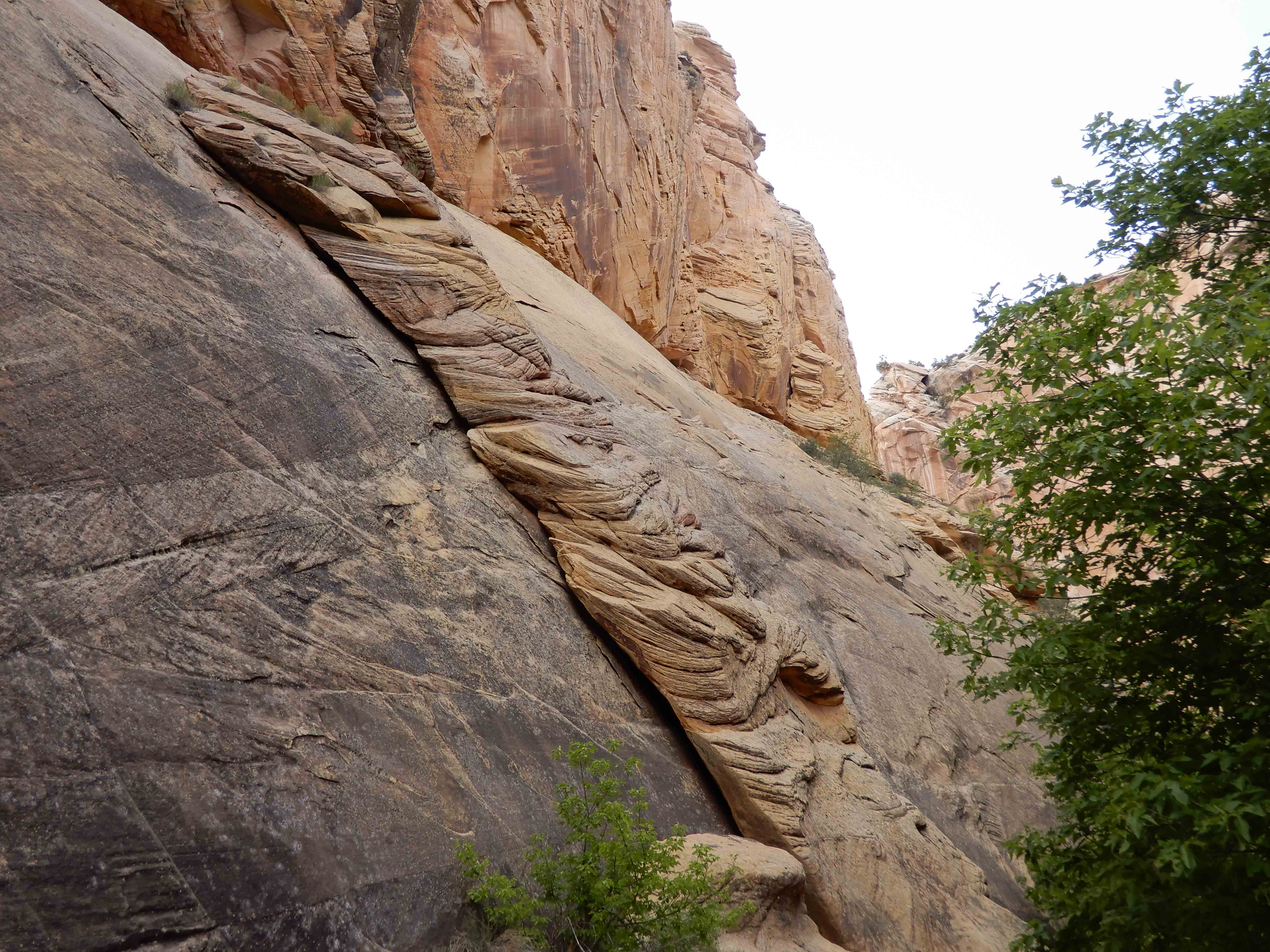
Geology Road Guide: Cottonwood Canyon by Janice Gillespie with Christa Sadler tells us that this feature did not turn into an arch because it is "at the intersection of a horizontal bedding plate between two layers of sandstone and a joint, or large crack, in the wall that angles up to the left. The result is a flat-bottomed, triangular shaped overhang."
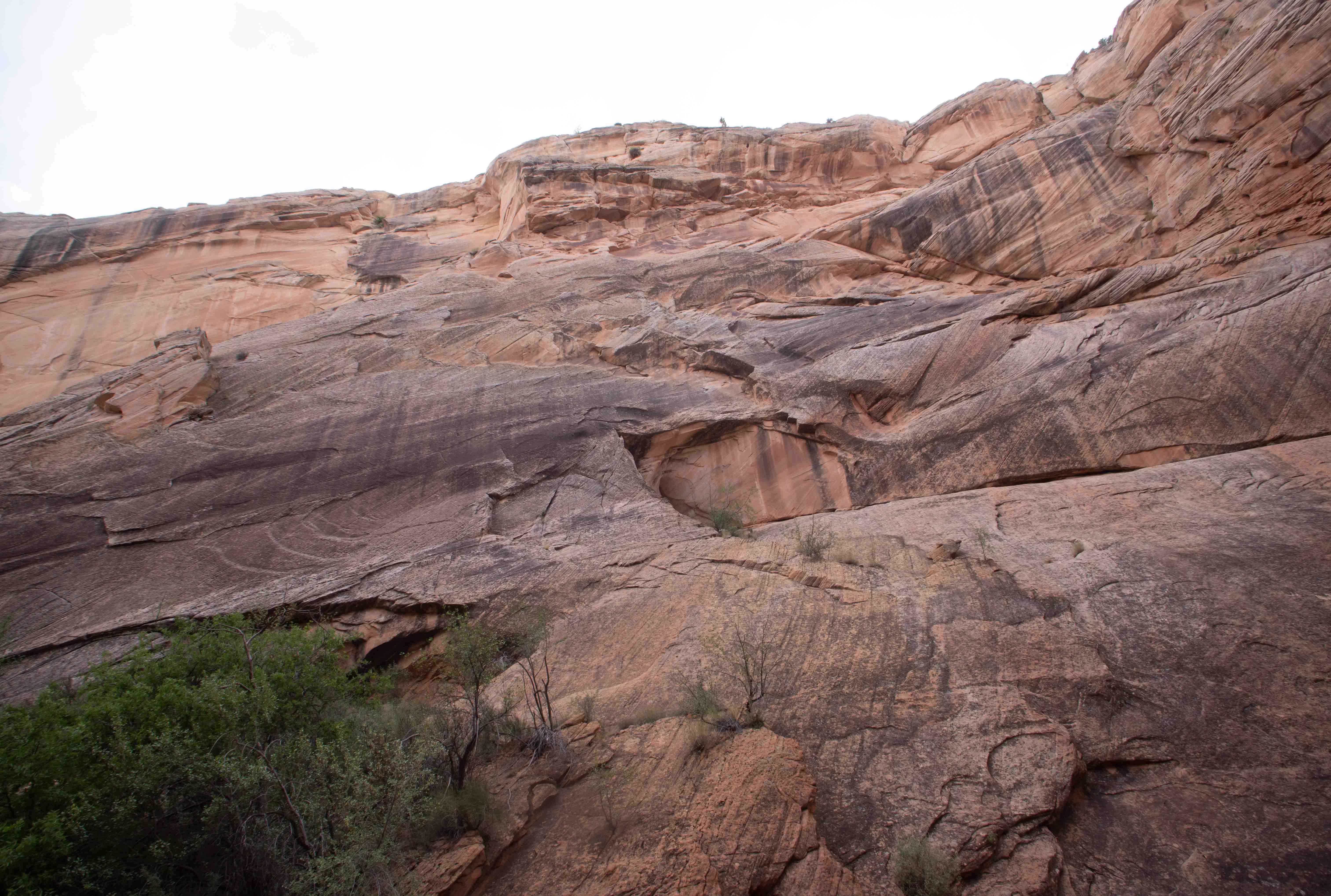
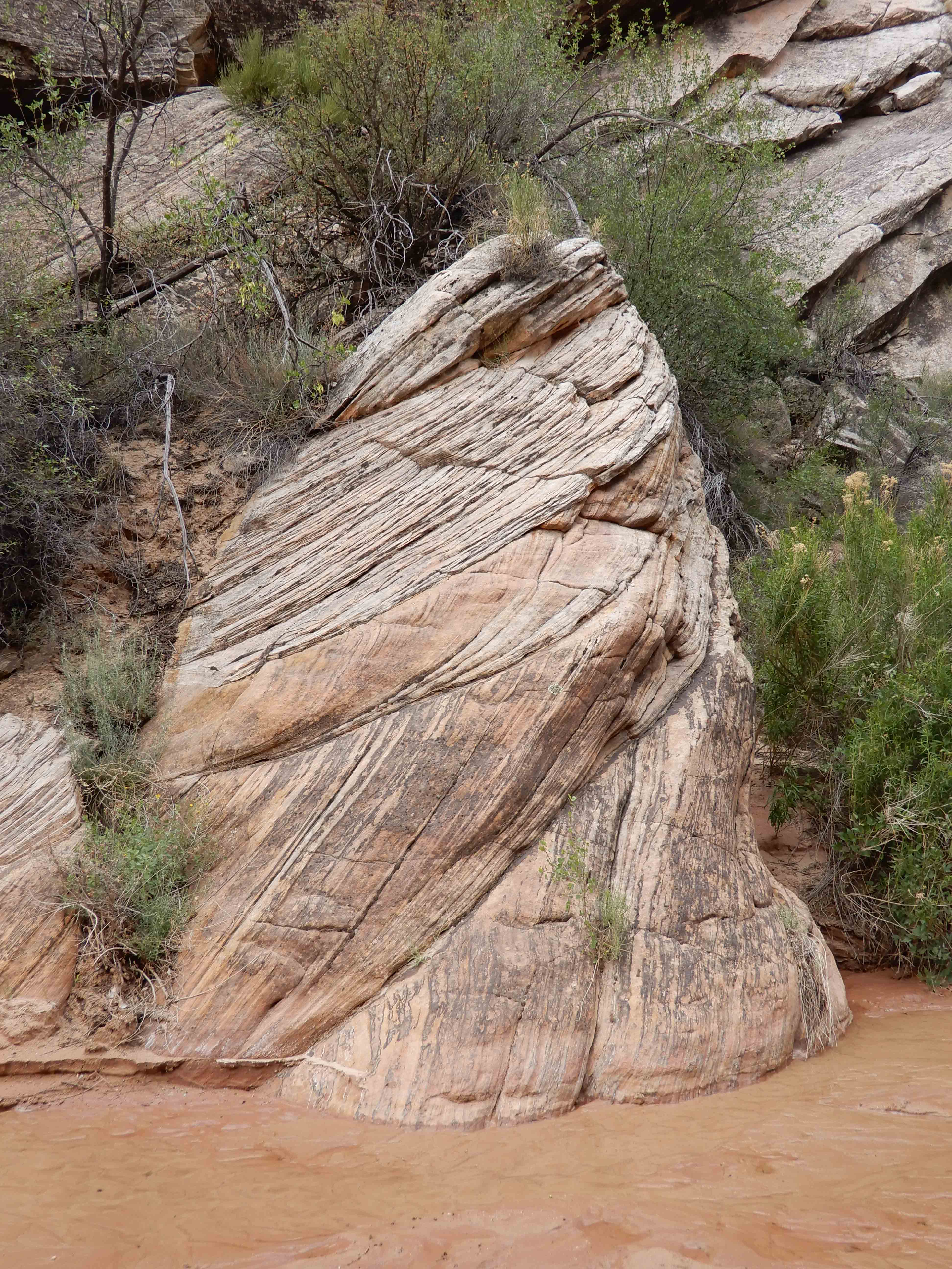
Detail of the striations in the lower part of the canyon wall.
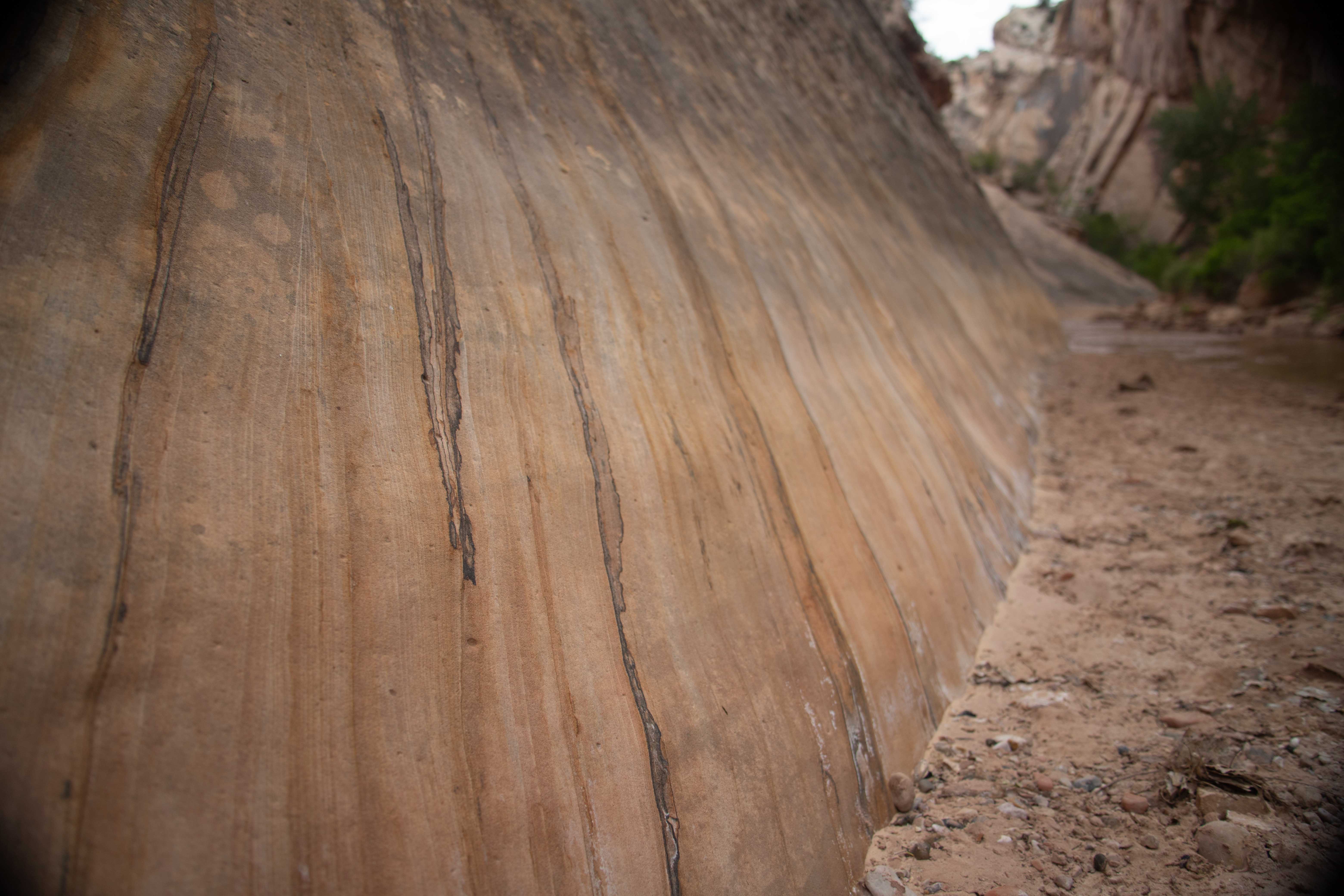
Eric took a picture of a nice feature exhibiting the characteristic crisscross patterns of Navajo Sandstone erosion.
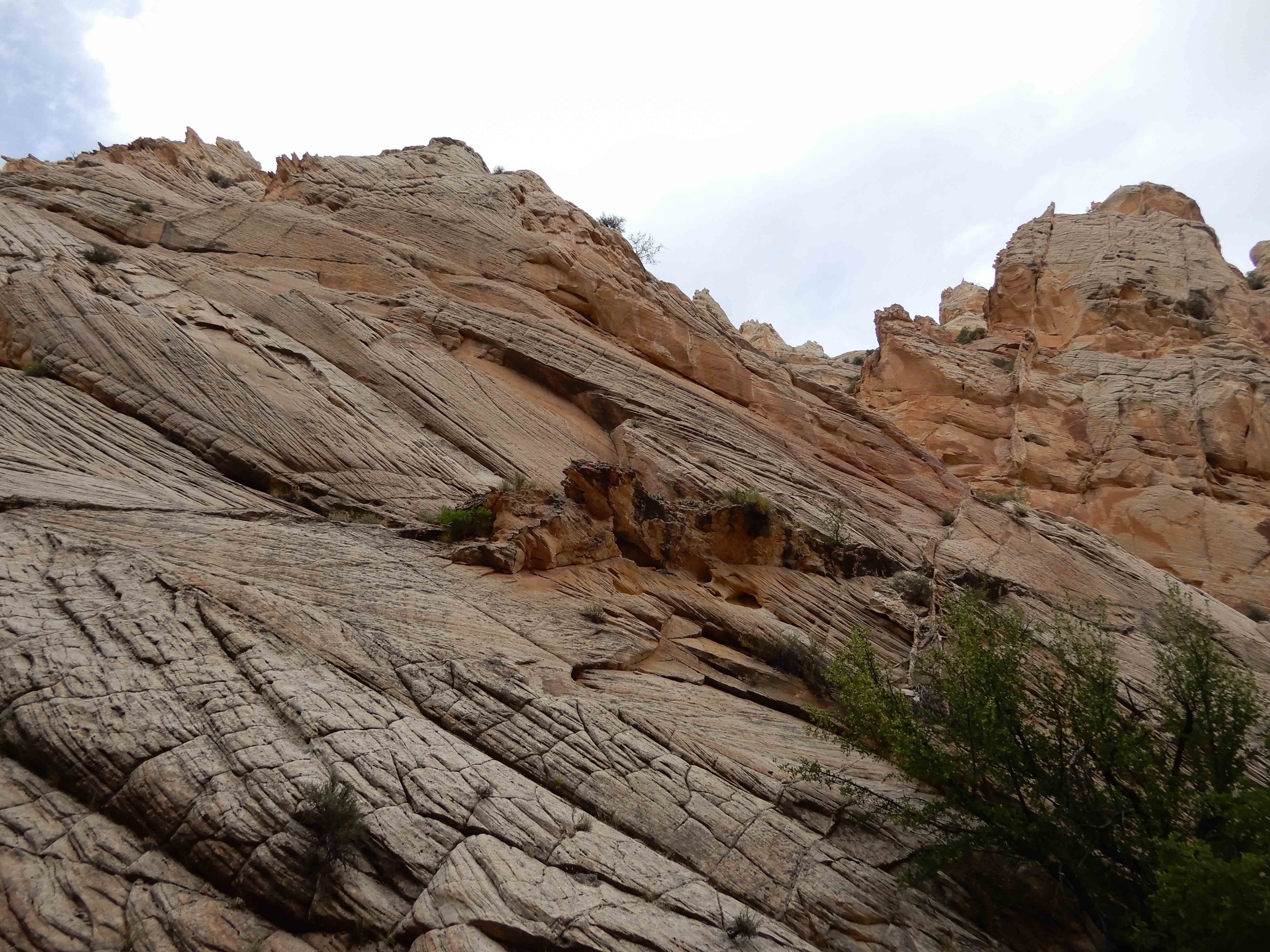
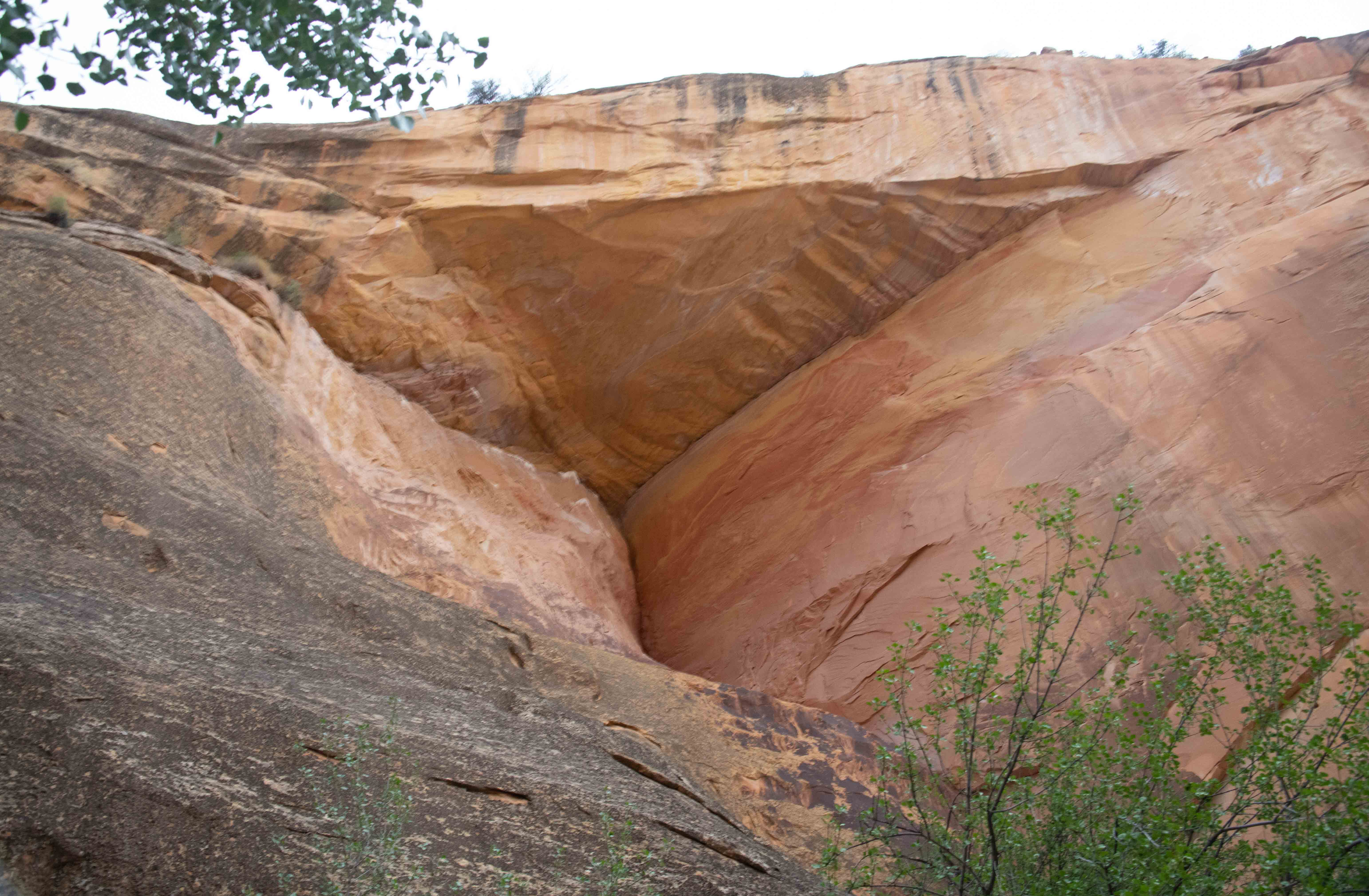
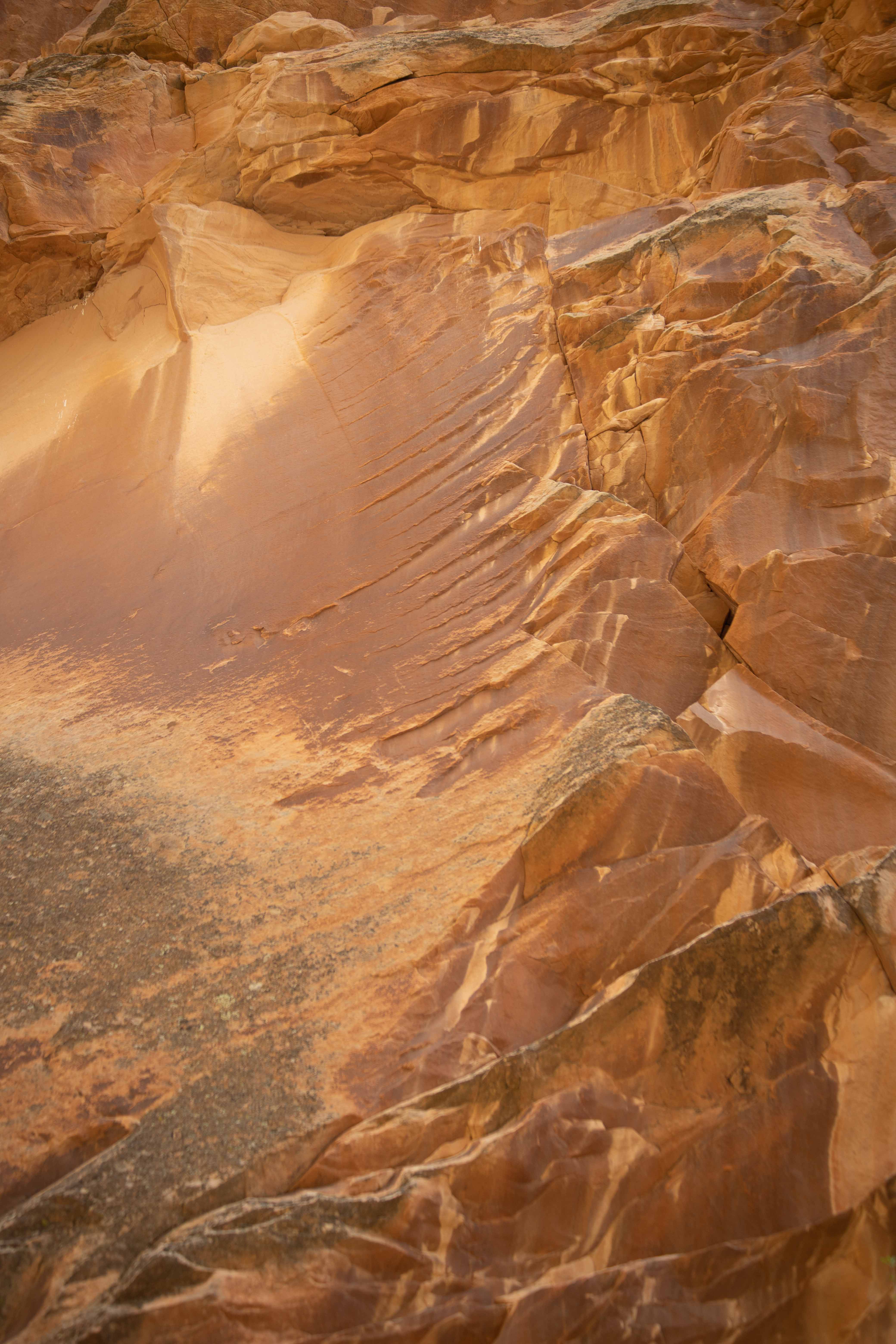
Features in the canyon walls.
Eric took a picture of another feature. I think this is soft sediment deposition.
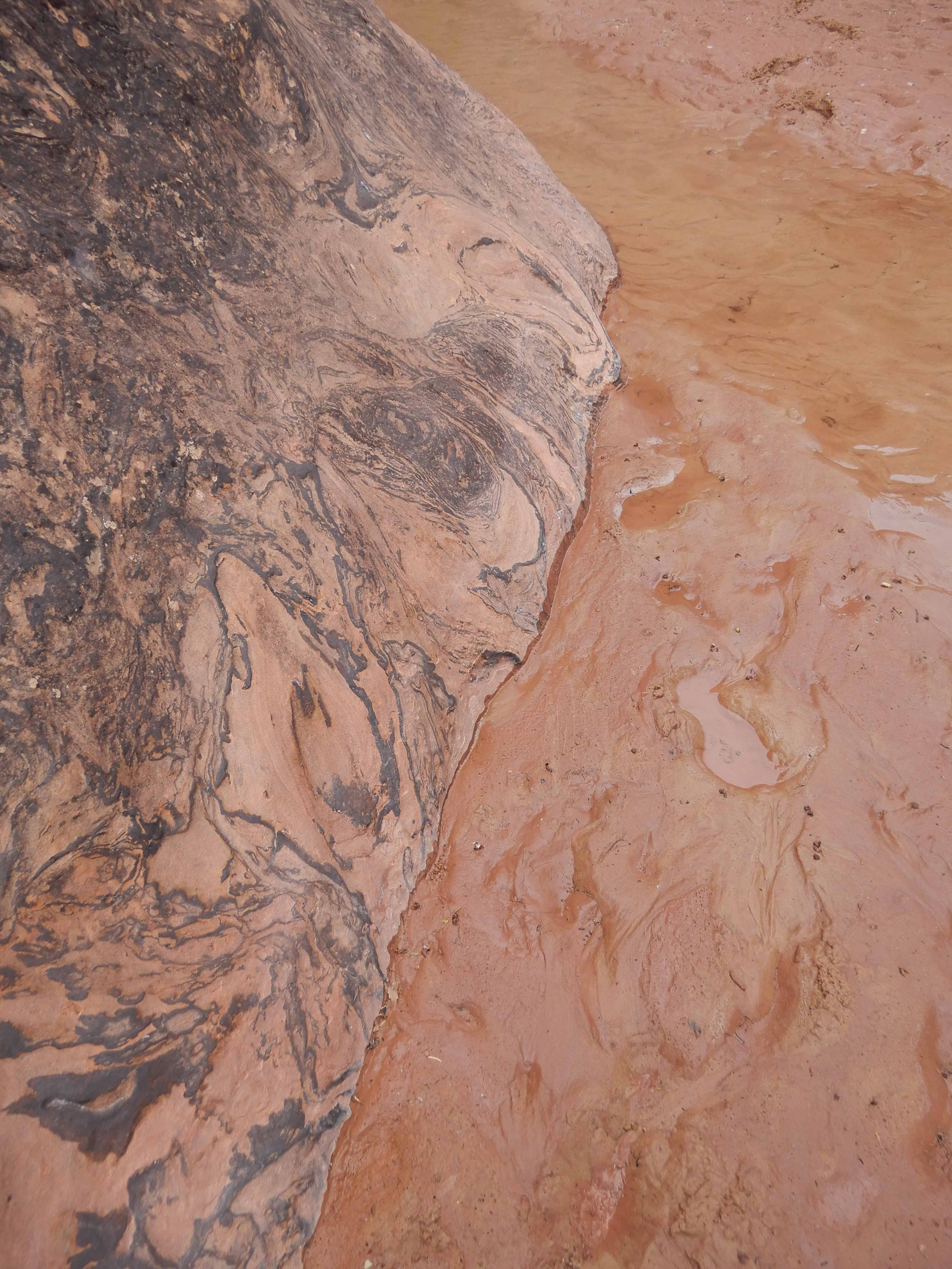
Odd features in the rock.
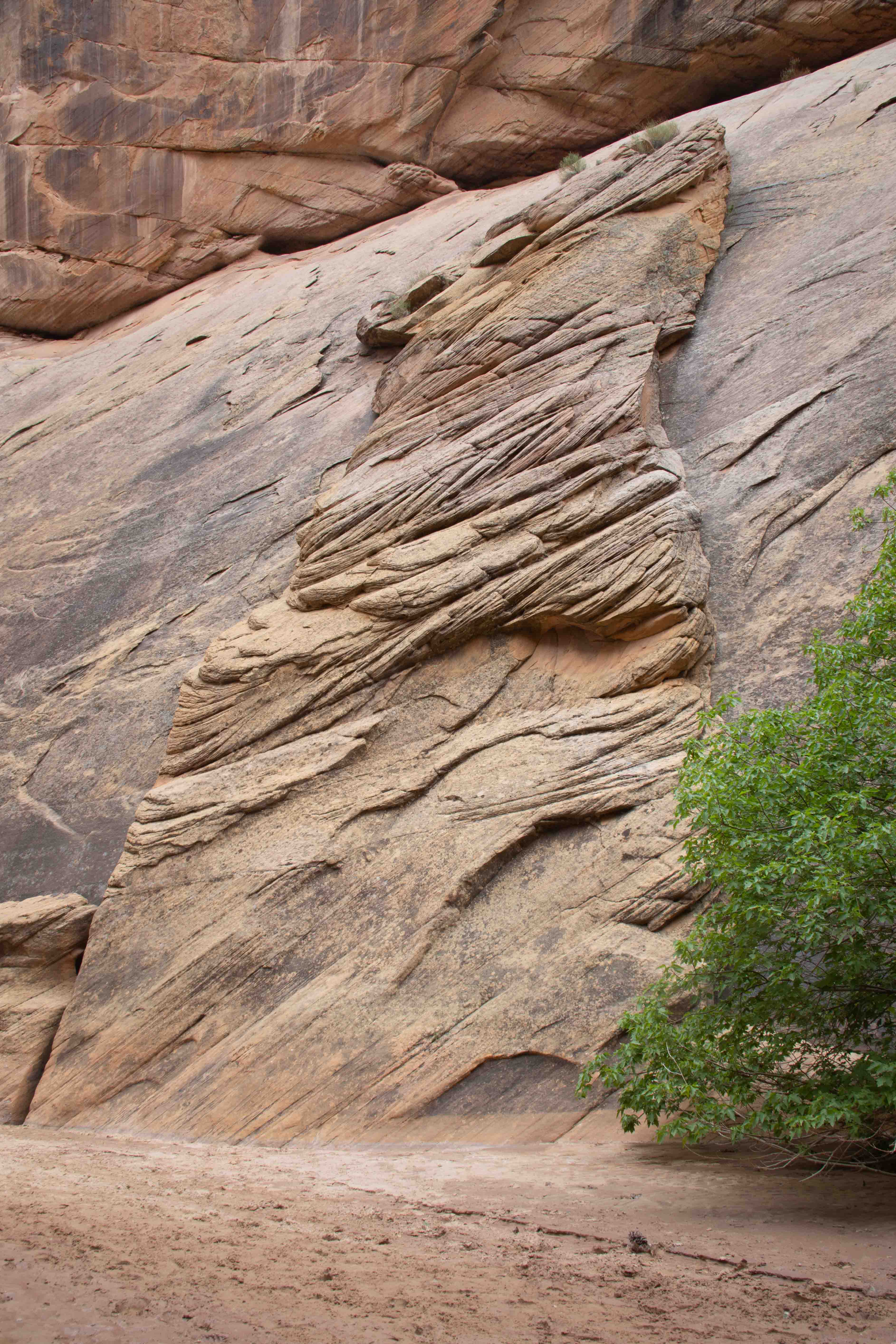
Eric shows this feature from the side.
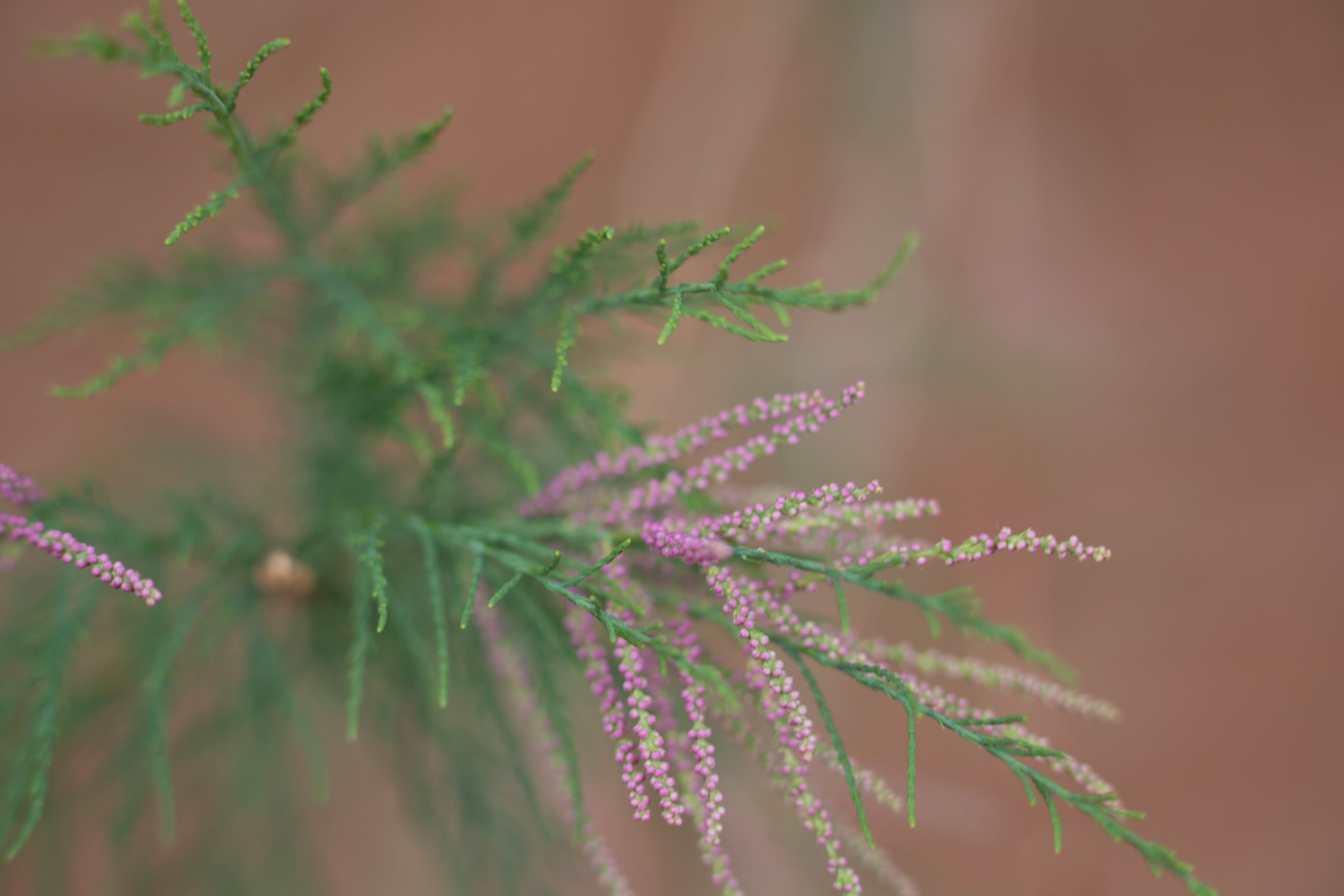
How strange! Purple and green needles on the same tree!
We had intended to spend the night in "dispersed camping" along Cottonwood Road, which means you get a permit from the ranger and then just park somewhere by the side of the road, set up your tent, and camp. Bring all your water with you, carry out your garbage, bury your poop with a shovel, stoves OK but no fires. However, between the cold temperatures we had been experiencing at Bryce and the inability to use Mather's electrical system to charge anything, we wimped out and abandoned this plan and went to a motel in Kanab.
On to Toadstools and Coral Pink Sand Dunes State Park.